Untersiggenthal night lights from space
Night Light of Untersiggenthal (Aargau) from space (Switzerland) Src. Average luminocity for 10x10km area is 25.7585% and for 50x50km: 16.1521%.
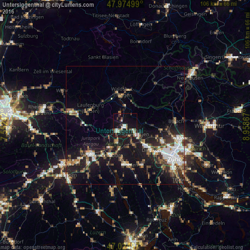
Analysis of Untersiggenthal night lights 2016
Square area 10x10 km:
 3.13%
3.13%90-99
6.11%80-89
1.56%70-79
0%60-69
2.7%50-59
5.4%40-49
3.84%30-39
3.55%20-29
4.26%10-19
36.36%0-9
33.1%Square area 50x50 km:
2.61%90-99
2.73%80-89
1.15%70-79
1.35%60-69
2.19%50-59
2.23%40-49
2.56%30-39
2.3%20-29
4.56%10-19
15.38%0-9
62.93%Clear (daylight) street map image can be seen on geolist.org.
Map coordinates:
47° 58' 30" North, 7° 33' 8.7" East
47° 30' 7.7" North, 8° 15' 19.9" East
47° 1' 29.9" North, 8° 57' 31.2" East
Some cities around Untersiggenthal sort by population:
• Wettingen
5.8 km =3.6 mi,  127°
127°
• Baden
5 km =3.1 mi, 130°
• Spreitenbach
12.2 km =7.6 mi,  136°
136°
• Brugg
4.2 km =2.6 mi,  236°
236°
• Obersiggenthal
3.5 km =2.2 mi,  117°
117°
• Neuenhof
7.9 km =4.9 mi, 137°
• Windisch
3.8 km =2.4 mi,  227°
227°
• Würenlos
10.5 km =6.5 mi, 129°
2658237 (p: 6,344)
Sources (retrieved 2019-11-25):
» Earth at Night: Flat Maps 2012, 2016