Herisau night lights from space
Night Light of Herisau (Appenzell Ausserrhoden) from space (Switzerland) Src. Average luminocity for 10x10km area is 19.5848% and for 50x50km: 5.6655%.
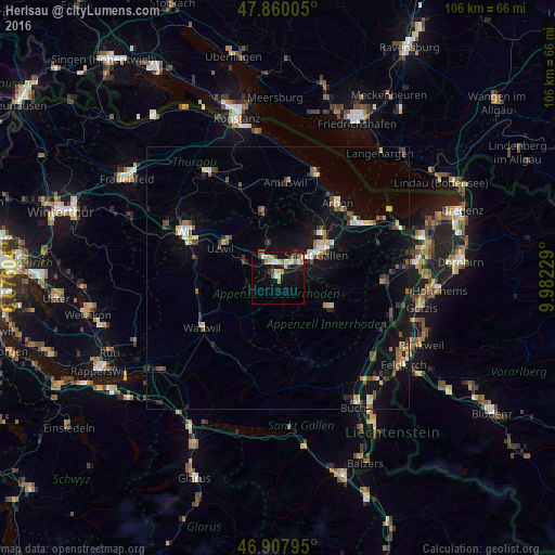
Analysis of Herisau night lights 2016
Square area 10x10 km:
 2.08%
2.08%90-99
3.87%80-89
3.13%70-79
2.98%60-69
2.38%50-59
1.34%40-49
1.49%30-39
1.93%20-29
2.38%10-19
19.49%0-9
58.93%Square area 50x50 km:
0.38%90-99
0.68%80-89
0.67%70-79
0.58%60-69
0.69%50-59
0.73%40-49
1.06%30-39
0.75%20-29
0.97%10-19
5.36%0-9
88.12%Clear (daylight) street map image can be seen on geolist.org.
Map coordinates:
47° 51' 36.2" North, 8° 34' 33.7" East
47° 23' 10.1" North, 9° 16' 45" East
46° 54' 28.6" North, 9° 58' 56.2" East
Some cities around Herisau sort by population:
• Sankt Gallen
8.3 km =5.2 mi,  59°
59°
• Gossau
3.7 km =2.3 mi,  330°
330°
• Uzwil
12.3 km =7.6 mi,  297°
297°
• Flawil
7.8 km =4.8 mi,  292°
292°
• Wittenbach
11.6 km =7.2 mi,  43°
43°
• Teufen
8.1 km =5 mi,  86°
86°
• Appenzell
11.6 km =7.2 mi,  121°
121°
• Oberuzwil
12.5 km =7.8 mi, 293°
2660365 (p: 15,438)
Sources (retrieved 2019-11-25):
» Earth at Night: Flat Maps 2012, 2016