Uzwil night lights from space
Night Light of Uzwil (Saint Gallen) from space (Switzerland) Src. Average luminocity for 10x10km area is 5.7798% and for 50x50km: 5.5025%.
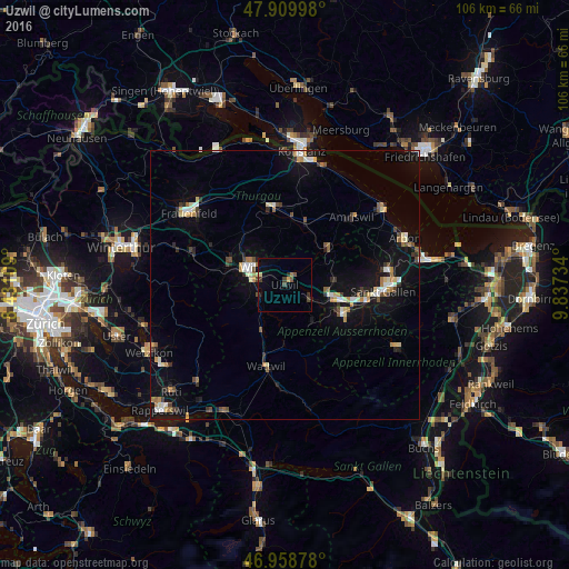
Analysis of Uzwil night lights 2016
Square area 10x10 km:
 0%
0%90-99
0%80-89
1.14%70-79
0.28%60-69
0.85%50-59
0.57%40-49
1.99%30-39
1.85%20-29
0.99%10-19
2.27%0-9
90.06%Square area 50x50 km:
0.57%90-99
0.72%80-89
0.67%70-79
0.66%60-69
0.64%50-59
0.45%40-49
0.8%30-39
0.66%20-29
0.8%10-19
4.79%0-9
89.24%Clear (daylight) street map image can be seen on geolist.org.
Map coordinates:
47° 54' 35.9" North, 8° 25' 51.9" East
47° 26' 11.5" North, 9° 8' 3.2" East
46° 57' 31.6" North, 9° 50' 14.4" East
Some cities around Uzwil sort by population:
• Gossau
9.4 km =5.8 mi,  104°
104°
• Wil
7.2 km =4.5 mi,  292°
292°
• Herisau
12.3 km =7.6 mi,  117°
117°
• Flawil
4.5 km =2.8 mi,  125°
125°
• Weinfelden
14.7 km =9.1 mi,  349°
349°
• Kirchberg
7.6 km =4.7 mi,  248°
248°
• Sirnach
10.7 km =6.6 mi, 285°
• Oberuzwil
0.8 km =0.5 mi,  219°
219°
2658209 (p: 12,111)
Sources (retrieved 2019-11-25):
» Earth at Night: Flat Maps 2012, 2016