Appenzell night lights from space
Night Light of Appenzell (Appenzell Innerrhoden) from space (Switzerland) Src. Average luminocity for 10x10km area is 2.0863% and for 50x50km: 8.8119%.
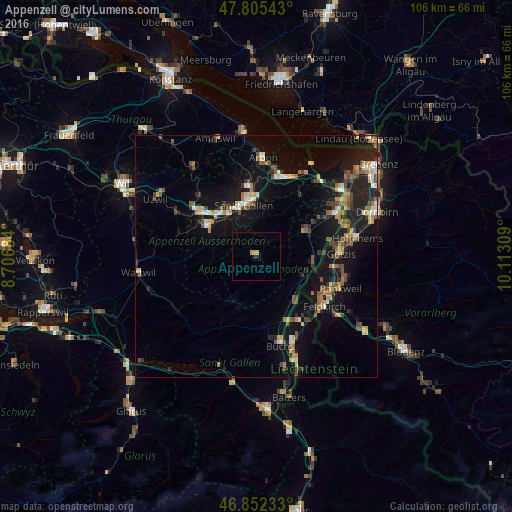
Analysis of Appenzell night lights 2016
Square area 10x10 km:
 0%
0%90-99
0%80-89
0.74%70-79
0.45%60-69
0.6%50-59
0%40-49
0%30-39
0%20-29
0.6%10-19
0.6%0-9
97.02%Square area 50x50 km:
0.48%90-99
1.14%80-89
0.79%70-79
1.12%60-69
1.39%50-59
1.34%40-49
1.63%30-39
1.28%20-29
2.2%10-19
9.11%0-9
79.52%Clear (daylight) street map image can be seen on geolist.org.
Map coordinates:
47° 48' 19.5" North, 8° 42' 24.6" East
47° 19' 51.7" North, 9° 24' 35.9" East
46° 51' 8.4" North, 10° 6' 47.1" East
Some cities around Appenzell sort by population:
• Sankt Gallen
10.7 km =6.6 mi,  345°
345°
• Herisau
11.6 km =7.2 mi,  301°
301°
• Altstätten
11.6 km =7.2 mi,  63°
63°
• Wittenbach
14.6 km =9.1 mi, 352°
• Oberriet
12 km =7.5 mi,  95°
95°
• Teufen
6.9 km =4.3 mi, 345°
• Ruggell, LI
13.5 km =8.4 mi,  139°
139°
• Gamprin, LI
14.4 km =8.9 mi,  148°
148°
2661740 (p: 5,649)
Sources (retrieved 2019-11-25):
» Earth at Night: Flat Maps 2012, 2016