Flawil night lights from space
Night Light of Flawil (Saint Gallen) from space (Switzerland) Src. Average luminocity for 10x10km area is 6.2599% and for 50x50km: 4.9582%.
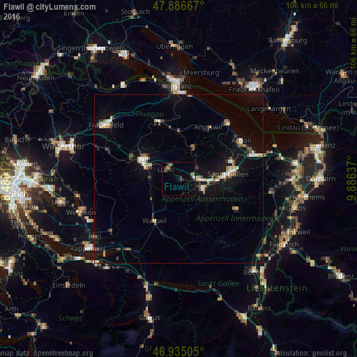
Analysis of Flawil night lights 2016
Square area 10x10 km:
 0.14%
0.14%90-99
0.71%80-89
0.28%70-79
0.28%60-69
0.85%50-59
1.7%40-49
1.42%30-39
1.56%20-29
1.28%10-19
2.56%0-9
89.2%Square area 50x50 km:
0.42%90-99
0.58%80-89
0.7%70-79
0.5%60-69
0.54%50-59
0.45%40-49
0.79%30-39
0.64%20-29
0.72%10-19
4.2%0-9
90.45%Clear (daylight) street map image can be seen on geolist.org.
Map coordinates:
47° 53' 12" North, 8° 28' 48.4" East
47° 24' 46.8" North, 9° 10' 59.7" East
46° 56' 6.2" North, 9° 53' 10.9" East
Some cities around Flawil sort by population:
• Sankt Gallen
14.5 km =9 mi,  85°
85°
• Gossau
5.4 km =3.4 mi, 87°
• Wil
11.7 km =7.3 mi,  297°
297°
• Herisau
7.8 km =4.8 mi,  112°
112°
• Uzwil
4.5 km =2.8 mi,  305°
305°
• Kirchberg
10.8 km =6.7 mi,  269°
269°
• Wattwil
14.6 km =9.1 mi,  209°
209°
• Oberuzwil
4.7 km =2.9 mi, 295°
2660762 (p: 9,739)
Sources (retrieved 2019-11-25):
» Earth at Night: Flat Maps 2012, 2016