Gstaad night lights from space
Night Light of Gstaad (Bern) from space (Switzerland) Src. Average luminocity for 10x10km area is 1.9318% and for 50x50km: 3.227%.
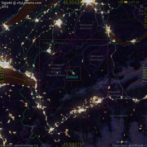
Analysis of Gstaad night lights 2016
Square area 10x10 km:
 0%
0%90-99
0%80-89
0%70-79
0.14%60-69
0.99%50-59
0.57%40-49
0.28%30-39
0.28%20-29
1.14%10-19
1.14%0-9
95.45%Square area 50x50 km:
0.27%90-99
0.36%80-89
0.22%70-79
0.3%60-69
0.37%50-59
0.68%40-49
0.62%30-39
0.53%20-29
0.8%10-19
3.22%0-9
92.63%Clear (daylight) street map image can be seen on geolist.org.
Map coordinates:
46° 57' 15.3" North, 6° 35' 1.4" East
46° 28' 19.7" North, 7° 17' 12.7" East
45° 59' 8.7" North, 7° 59' 23.9" East
Some cities around Gstaad sort by population:
• Sitten
27.7 km =17.2 mi,  169°
169°
• Montreux
29.1 km =18.1 mi,  261°
261°
• Sierre
27.7 km =17.2 mi,  136°
136°
• Bulle
23.9 km =14.9 mi,  312°
312°
• Ollon
29.9 km =18.6 mi,  228°
228°
• Conthey
27.7 km =17.2 mi,  177°
177°
• Saanen
2.8 km =1.7 mi, 313°
• Savièse
25 km =15.5 mi, 169°
2660461 (p: 9,200)
Sources (retrieved 2019-11-25):
» Earth at Night: Flat Maps 2012, 2016