Ollon night lights from space
Night Light of Ollon (Vaud) from space (Switzerland) Src. Average luminocity for 10x10km area is 18.0387% and for 50x50km: 6.4253%.
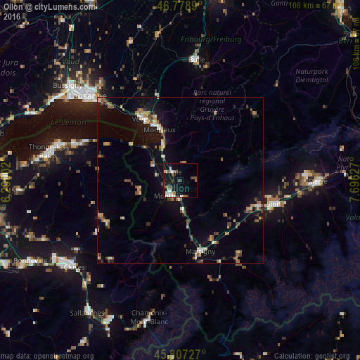
Analysis of Ollon night lights 2016
Square area 10x10 km:
 2.53%
2.53%90-99
3.42%80-89
1.79%70-79
0.74%60-69
1.64%50-59
4.02%40-49
2.23%30-39
2.38%20-29
1.04%10-19
22.32%0-9
57.89%Square area 50x50 km:
0.44%90-99
0.81%80-89
0.69%70-79
0.79%60-69
0.81%50-59
1.19%40-49
1.13%30-39
0.86%20-29
0.68%10-19
4.88%0-9
87.73%Clear (daylight) street map image can be seen on geolist.org.
Map coordinates:
46° 46' 44" North, 6° 17' 24.1" East
46° 17' 42.9" North, 6° 59' 35.3" East
45° 48' 26.2" North, 7° 41' 46.6" East
Some cities around Ollon sort by population:
• Montreux
16.6 km =10.3 mi,  337°
337°
• Monthey
5.4 km =3.4 mi,  213°
213°
• La Tour-de-Peilz
20.4 km =12.7 mi,  329°
329°
• Aigle
3.4 km =2.1 mi,  319°
319°
• Bex
5.2 km =3.2 mi,  165°
165°
• Collombey
4.2 km =2.6 mi,  235°
235°
• Fully
19.8 km =12.3 mi,  151°
151°
• Blonay
20.6 km =12.8 mi, 338°
2659298 (p: 6,665)
Sources (retrieved 2019-11-25):
» Earth at Night: Flat Maps 2012, 2016