Châtel-Saint-Denis night lights from space
Night Light of Châtel-Saint-Denis (Fribourg) from space (Switzerland) Src. Average luminocity for 10x10km area is 6.7528% and for 50x50km: 7.7763%.
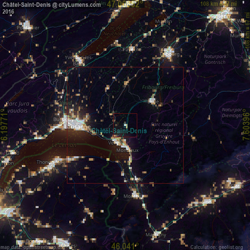
Analysis of Châtel-Saint-Denis night lights 2016
Square area 10x10 km:
 0.28%
0.28%90-99
0.28%80-89
0.71%70-79
0.99%60-69
0%50-59
0.85%40-49
0.85%30-39
1.56%20-29
0.57%10-19
11.93%0-9
81.96%Square area 50x50 km:
1%90-99
1.19%80-89
0.63%70-79
0.79%60-69
0.89%50-59
1.01%40-49
1.15%30-39
1.19%20-29
2.01%10-19
5.42%0-9
84.72%Clear (daylight) street map image can be seen on geolist.org.
Map coordinates:
47° 0' 30.7" North, 6° 11' 51.8" East
46° 31' 36.9" North, 6° 54' 3" East
46° 2' 27.6" North, 7° 36' 14.3" East
Some cities around Châtel-Saint-Denis sort by population:
• Montreux
10.5 km =6.5 mi,  175°
175°
• Vevey
8.4 km =5.2 mi,  211°
211°
• Bulle
15.6 km =9.7 mi,  49°
49°
• La Tour-de-Peilz
8.8 km =5.5 mi,  201°
201°
• Ecublens
11.4 km =7.1 mi,  321°
321°
• Lutry
16.6 km =10.3 mi,  260°
260°
• Epalinges
18 km =11.2 mi,  277°
277°
• Blonay
6.6 km =4.1 mi, 183°
2661202 (p: 5,094)
Sources (retrieved 2019-11-25):
» Earth at Night: Flat Maps 2012, 2016