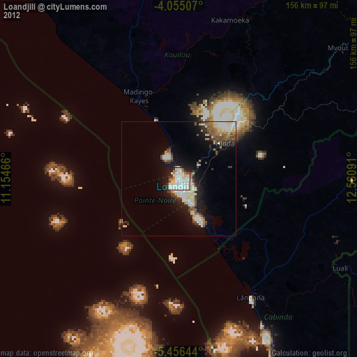
Loandjili night lights from space
Night Light of Loandjili (Pointe-Noire) from space (Republic of the Congo) Src. Average luminocity for 10x10km area is 75.5764% and for 50x50km: 12.7462%.
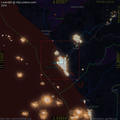
Analysis of Loandjili night lights 2016
Square area 10x10 km:
 33.26%
90-99
21.28%80-89
4.34%70-79
3.93%60-69
4.55%50-59
6.4%40-49
5.99%30-39
9.71%20-29
10.54%10-19
0%0-9
0%Square area 50x50 km:
2.69%90-99
3.64%80-89
1%70-79
0.6%60-69
0.96%50-59
1.15%40-49
1.61%30-39
2.05%20-29
4.02%10-19
7.16%0-9
75.12%Clear (daylight) street map image can be seen on geolist.org.
Map coordinates:
4° 3' 18.3" South, 11° 9' 16.8" East
4° 45' 22" South, 11° 51' 28" East
5° 27' 23.2" South, 12° 33' 39.3" East
Some cities around Loandjili sort by population:
• Pointe-Noire
2.3 km =1.4 mi,  164°
164°
• Dolisie
109 km =67.7 mi,  55°
55°
• Soio, AO
163.4 km =101.5 mi, 159°
• Cabinda, AO
96.1 km =59.7 mi, 156°
• Kayes
169.8 km =105.5 mi,  68°
68°
• Moanda, CD
142.1 km =88.3 mi, 156°
• Tshela, CD
123.8 km =76.9 mi,  102°
102°
• Loango
12.6 km =7.8 mi,  336°
336°
2258378 (p: 23,204)
Sources (retrieved 2019-11-25):
» Earth at Night: Flat Maps 2012, 2016