Tsawwassen night lights from space
Night Light of Tsawwassen (British Columbia) from space (Canada) Src. Average luminocity for 10x10km area is 24.1012% and for 50x50km: 21.7459%.
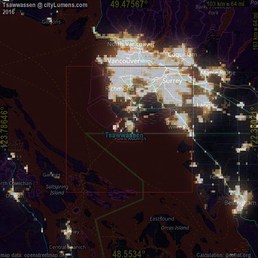
Analysis of Tsawwassen night lights 2016
Square area 10x10 km:
 3.42%
3.42%90-99
3.42%80-89
1.64%70-79
2.83%60-69
2.23%50-59
5.8%40-49
3.13%30-39
1.34%20-29
6.1%10-19
31.25%0-9
38.84%Square area 50x50 km:
8.18%90-99
5.54%80-89
1.7%70-79
1.53%60-69
1.28%50-59
1.75%40-49
2.04%30-39
2.79%20-29
3.48%10-19
5%0-9
66.71%Clear (daylight) street map image can be seen on geolist.org.
Map coordinates:
49° 28' 32.4" North, 123° 47' 11.3" West
49° 1' 0" North, 123° 4' 60" West
48° 33' 12.2" North, 122° 22' 48.8" West
Some cities around Tsawwassen sort by population:
• Vancouver
26 km =16.2 mi,  354°
354°
• Surrey
21.3 km =13.2 mi,  62°
62°
• Ladner
8.1 km =5 mi,  0°
0°
• Richmond
17.5 km =10.9 mi, 347°
• Delta
19.1 km =11.9 mi,  42°
42°
• White Rock
20.5 km =12.7 mi,  90°
90°
• New Westminster
24.6 km =15.3 mi,  30°
30°
• Blaine, US
24.7 km =15.3 mi,  95°
95°
6169661 (p: 21,588)
Sources (retrieved 2019-11-25):
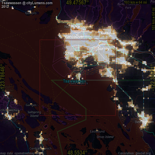
» Earth at Night: Flat Maps 2012, 2016