Vancouver night lights from space
Night Light of Vancouver (British Columbia) from space (Canada) Src. Average luminocity for 10x10km area is 93.5682% and for 50x50km: 31.3668%.
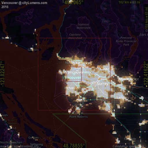

Analysis of Vancouver night lights 2016
Square area 10x10 km:
 68.05%
90-99
18.58%80-89
2.27%70-79
1.07%60-69
1.74%50-59
1.34%40-49
3.21%30-39
3.34%20-29
0.4%10-19
0%0-9
0%Square area 50x50 km:
11.62%90-99
8.42%80-89
2.67%70-79
2.43%60-69
2.14%50-59
2.54%40-49
2.25%30-39
3.07%20-29
4.99%10-19
6.88%0-9
52.99%Clear (daylight) street map image can be seen on geolist.org.
Map coordinates:
49° 42' 23.4" North, 123° 49' 20.9" West
49° 14' 58.8" North, 123° 7' 9.6" West
48° 47' 18.8" North, 122° 24' 58.4" West
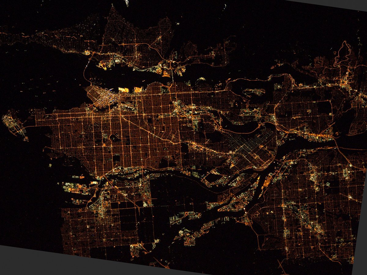
Fantastic image of Vancouver from space taken by astronauts [src2], but I don't have information about it's orientation, scale or angle. If necessary, it was rotated manually, so North points approximately to upper direction. Click to zoom in:
Some cities around Vancouver sort by population:
• Burnaby
12.2 km =7.6 mi,  81°
81°
• Ladner
18 km =11.2 mi,  171°
171°
• Richmond
8.9 km =5.5 mi,  188°
188°
• Delta
19.4 km =12.1 mi,  127°
127°
• New Westminster
15.9 km =9.9 mi,  107°
107°
• North Vancouver
8.3 km =5.2 mi,  26°
26°
• West End
3.9 km =2.4 mi,  344°
344°
• West Vancouver
13.5 km =8.4 mi,  345°
345°
6173331 (p: 600,000)
Sources (retrieved 2019-11-25):
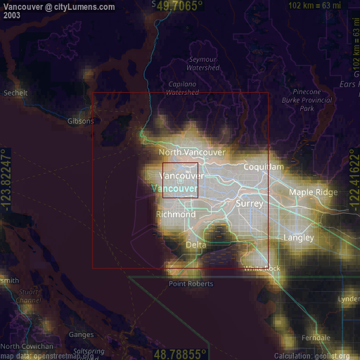
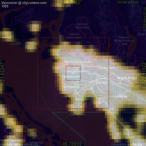
» NASA, Earths city lights 1995
» NASA city lights 2003
» Earth at Night: Flat Maps 2012, 2016
Src.2: Tim Kopra, Twitter/@astro_tim, 2016-04-01