St. Thomas night lights from space
Night Light of St. Thomas (Ontario) from space (Canada) Src. Average luminocity for 10x10km area is 37.3864% and for 50x50km: 10.1528%.

Analysis of St. Thomas night lights 2016
Square area 10x10 km:
 7.27%
7.27%90-99
9.09%80-89
3.79%70-79
2.88%60-69
4.39%50-59
2.88%40-49
4.24%30-39
4.09%20-29
6.82%10-19
40.91%0-9
13.64%Square area 50x50 km:
1.99%90-99
2.45%80-89
1.35%70-79
0.96%60-69
1.08%50-59
0.75%40-49
0.89%30-39
1.18%20-29
2.29%10-19
5.5%0-9
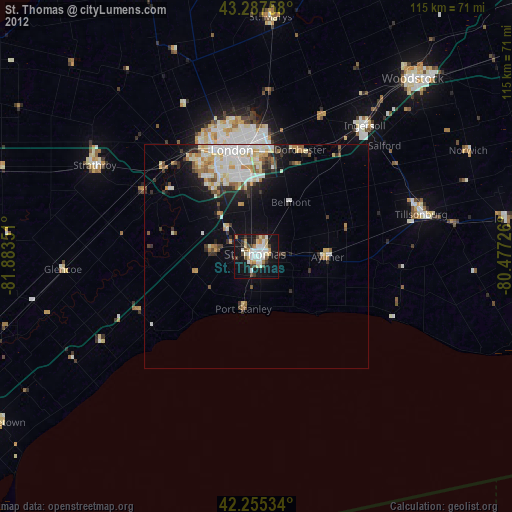
81.56%Clear (daylight) street map image can be seen on geolist.org.
Map coordinates:
43° 17' 15.3" North, 81° 53' 0.6" West
42° 46' 25" North, 81° 10' 49.4" West
42° 15' 19.2" North, 80° 28' 38.1" West
Some cities around St. Thomas sort by population:
• London
23.7 km =14.7 mi,  349°
349°
• Norfolk County
65.4 km =40.6 mi,  84°
84°
• Woodstock
53.2 km =33.1 mi,  41°
41°
• Stratford
68.6 km =42.6 mi,  15°
15°
• Ingersoll
37.7 km =23.4 mi, 39°
• South Huron
66.3 km =41.2 mi,  335°
335°
• Dorchester
25.1 km =15.6 mi, 21°
• Aylmer
16.1 km =10 mi,  92°
92°
6158357 (p: 36,110)
Sources (retrieved 2019-11-25):
» Earth at Night: Flat Maps 2012, 2016