South Huron night lights from space
Night Light of South Huron (Ontario) from space (Canada) Src. Average luminocity for 10x10km area is 6.4288% and for 50x50km: 0.9623%.
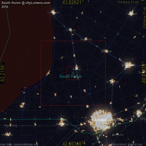
Analysis of South Huron night lights 2016
Square area 10x10 km:
 0.3%
0.3%90-99
1.21%80-89
0.61%70-79
2.12%60-69
0.45%50-59
0.45%40-49
0%30-39
1.21%20-29
2.42%10-19
1.82%0-9
89.39%Square area 50x50 km:
0.03%90-99
0.1%80-89
0.16%70-79
0.18%60-69
0.16%50-59
0.12%40-49
0.09%30-39
0.22%20-29
0.34%10-19
0.12%0-9
98.5%Clear (daylight) street map image can be seen on geolist.org.
Map coordinates:
43° 49' 34.4" North, 82° 13' 10.6" West
43° 19' 0.4" North, 81° 30' 59.3" West
42° 48' 11" North, 80° 48' 48.1" West
Some cities around South Huron sort by population:
• London
43.6 km =27.1 mi,  148°
148°
• Stratford
46.2 km =28.7 mi,  83°
83°
• Ingersoll
60.3 km =37.5 mi,  121°
121°
• Lambton Shores
37.6 km =23.4 mi,  243°
243°
• Dorchester
52 km =32.3 mi,  135°
135°
• Huron East
37.7 km =23.4 mi,  27°
27°
• Goderich
49.8 km =30.9 mi,  341°
341°
• Bluewater
18 km =11.2 mi, 338°
6152244 (p: 9,982)
Sources (retrieved 2019-11-25):
» Earth at Night: Flat Maps 2012, 2016