Norfolk County night lights from space
Night Light of Norfolk County (Ontario) from space (Canada) Src. Average luminocity for 10x10km area is 3.6% and for 50x50km: 2.4927%.

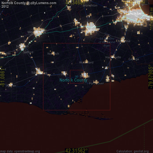
Analysis of Norfolk County night lights 2016
Square area 10x10 km:
 0%
0%90-99
0%80-89
0.3%70-79
1.52%60-69
0%50-59
0%40-49
1.21%30-39
0%20-29
0.45%10-19
2.27%0-9
94.24%Square area 50x50 km:
0.14%90-99
0.33%80-89
0.36%70-79
0.22%60-69
0.54%50-59
0.4%40-49
0.4%30-39
0.31%20-29
0.48%10-19
0.5%0-9
96.34%Clear (daylight) street map image can be seen on geolist.org.
Map coordinates:
43° 20' 48.7" North, 81° 5' 10" West
42° 50' 0.2" North, 80° 22' 58.7" West
42° 18' 56.2" North, 79° 40' 47.5" West
Some cities around Norfolk County sort by population:
• Brantford
34.7 km =21.6 mi,  15°
15°
• Woodstock
44.7 km =27.8 mi,  318°
318°
• Brant
33.5 km =20.8 mi,  4°
4°
• Ancaster
53.5 km =33.2 mi,  36°
36°
• Simcoe
6.8 km =4.2 mi,  90°
90°
• Ingersoll
46.4 km =28.8 mi,  298°
298°
• Paris
40.8 km =25.4 mi,  359°
359°
• Aylmer
49.5 km =30.8 mi,  261°
261°
6089125 (p: 60,847)
Sources (retrieved 2019-11-25):
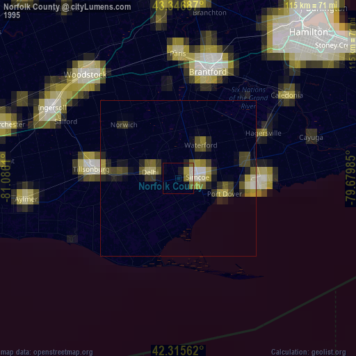
» NASA, Earths city lights 1995
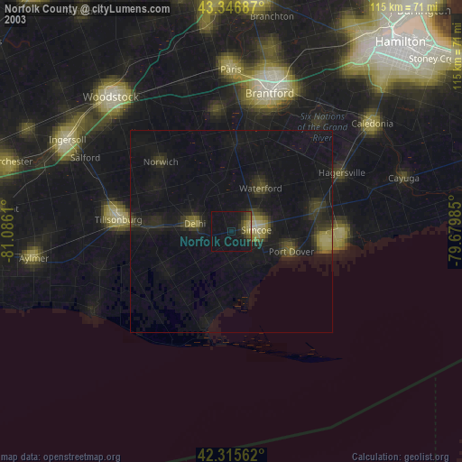
» NASA city lights 2003
» Earth at Night: Flat Maps 2012, 2016