Dorchester night lights from space
Night Light of Dorchester (Ontario) from space (Canada) Src. Average luminocity for 10x10km area is 16.3714% and for 50x50km: 15.2887%.
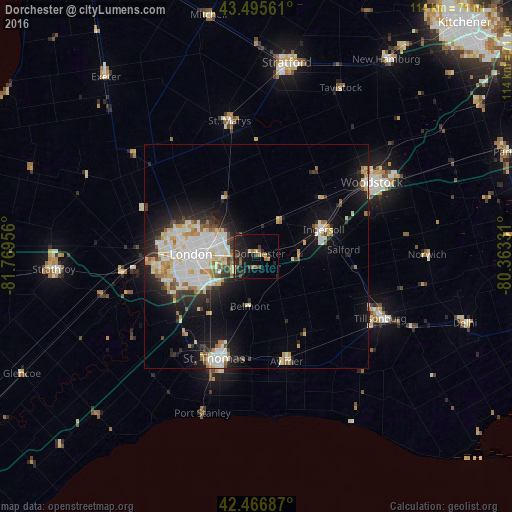
Analysis of Dorchester night lights 2016
Square area 10x10 km:
 0%
0%90-99
1.27%80-89
0.79%70-79
2.38%60-69
2.22%50-59
1.75%40-49
5.08%30-39
3.02%20-29
10%10-19
18.41%0-9
55.08%Square area 50x50 km:
3.24%90-99
3.81%80-89
1.91%70-79
1.43%60-69
1.48%50-59
0.97%40-49
1.17%30-39
1.58%20-29
3.65%10-19
8.54%0-9
72.22%Clear (daylight) street map image can be seen on geolist.org.
Map coordinates:
43° 29' 44.2" North, 81° 46' 10.4" West
42° 59' 0.2" North, 81° 3' 59.1" West
42° 28' 0.7" North, 80° 21' 47.9" West
Some cities around Dorchester sort by population:
• London
13.6 km =8.5 mi,  270°
270°
• Woodstock
30.7 km =19.1 mi,  57°
57°
• St. Thomas
25.1 km =15.6 mi,  201°
201°
• Stratford
43.7 km =27.2 mi,  12°
12°
• New Hamburg
53.5 km =33.2 mi,  33°
33°
• Ingersoll
15.9 km =9.9 mi,  69°
69°
• South Huron
52 km =32.3 mi,  315°
315°
• Aylmer
25 km =15.5 mi,  164°
164°
5941761 (p: 9,329)
Sources (retrieved 2019-11-25):
» Earth at Night: Flat Maps 2012, 2016