Simcoe night lights from space
Night Light of Simcoe (Ontario) from space (Canada) Src. Average luminocity for 10x10km area is 16.9258% and for 50x50km: 2.6887%.
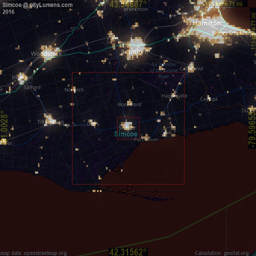
Analysis of Simcoe night lights 2016
Square area 10x10 km:
 2.12%
2.12%90-99
3.33%80-89
1.36%70-79
2.42%60-69
3.03%50-59
1.36%40-49
2.12%30-39
0.61%20-29
1.67%10-19
10.3%0-9
71.67%Square area 50x50 km:
0.16%90-99
0.34%80-89
0.35%70-79
0.26%60-69
0.59%50-59
0.41%40-49
0.52%30-39
0.34%20-29
0.54%10-19
0.49%0-9
96%Clear (daylight) street map image can be seen on geolist.org.
Map coordinates:
43° 20' 48.7" North, 81° 0' 10.1" West
42° 50' 0.2" North, 80° 17' 58.8" West
42° 18' 56.2" North, 79° 35' 47.6" West
Some cities around Simcoe sort by population:
• Brantford
33.5 km =20.8 mi,  4°
4°
• Norfolk County
6.8 km =4.2 mi,  270°
270°
• Woodstock
49.5 km =30.8 mi,  312°
312°
• Brant
33.6 km =20.9 mi,  353°
353°
• Ancaster
49.7 km =30.9 mi,  30°
30°
• Ingersoll
52.4 km =32.6 mi,  295°
295°
• Paris
41.3 km =25.7 mi, 350°
• Binbrook
51 km =31.7 mi,  51°
51°
6147962 (p: 13,922)
Sources (retrieved 2019-11-25):
» Earth at Night: Flat Maps 2012, 2016