Port Hope night lights from space
Night Light of Port Hope (Ontario) from space (Canada) Src. Average luminocity for 10x10km area is 0.381% and for 50x50km: 3.462%.
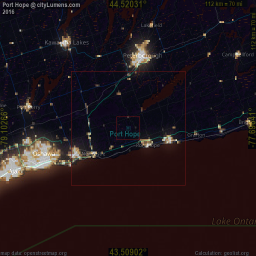
Analysis of Port Hope night lights 2016
Square area 10x10 km:
 0%
0%90-99
0%80-89
0%70-79
0%60-69
0%50-59
0%40-49
0%30-39
0%20-29
0.63%10-19
0.32%0-9
99.05%Square area 50x50 km:
0.25%90-99
0.43%80-89
0.51%70-79
0.26%60-69
0.39%50-59
0.6%40-49
0.59%30-39
0.54%20-29
0.62%10-19
2.3%0-9
93.5%Clear (daylight) street map image can be seen on geolist.org.
Map coordinates:
44° 31' 13.1" North, 79° 6' 9.6" West
44° 1' 0.6" North, 78° 23' 58.3" West
43° 30' 32.5" North, 77° 41' 47.1" West
Some cities around Port Hope sort by population:
• Oshawa
38.3 km =23.8 mi,  250°
250°
• Ajax
54 km =33.6 mi, 249°
• Pickering
60.1 km =37.3 mi,  257°
257°
• Peterborough
32.2 km =20 mi,  11°
11°
• Quinte West
69.1 km =42.9 mi,  74°
74°
• Lindsay
45.6 km =28.3 mi,  324°
324°
• Cobourg
19.8 km =12.3 mi,  108°
108°
• Uxbridge
58 km =36 mi,  279°
279°
6111882 (p: 12,587)
Sources (retrieved 2019-11-25):
» Earth at Night: Flat Maps 2012, 2016