Pickering night lights from space
Night Light of Pickering (Ontario) from space (Canada) Src. Average luminocity for 10x10km area is 23.5968% and for 50x50km: 39.4141%.
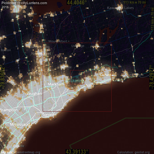
Analysis of Pickering night lights 2016
Square area 10x10 km:
 0.32%
0.32%90-99
1.27%80-89
0.32%70-79
2.86%60-69
5.08%50-59
1.43%40-49
4.76%30-39
10.79%20-29
20.16%10-19
24.44%0-9
28.57%Square area 50x50 km:
14.09%90-99
10.55%80-89
3.51%70-79
2.88%60-69
2.77%50-59
2.78%40-49
3.51%30-39
4.31%20-29
6.82%10-19
8.5%0-9
40.28%Clear (daylight) street map image can be seen on geolist.org.
Map coordinates:
44° 24' 16.6" North, 79° 50' 9.7" West
43° 54' 0.4" North, 79° 7' 58.4" West
43° 23' 28.8" North, 78° 25' 47.2" West
Some cities around Pickering sort by population:
• North York
27.1 km =16.8 mi,  236°
236°
• Scarborough
17.3 km =10.7 mi,  214°
214°
• Oshawa
22.7 km =14.1 mi,  90°
90°
• Markham
11.3 km =7 mi,  250°
250°
• Richmond Hill
24.6 km =15.3 mi,  262°
262°
• Ajax
9.8 km =6.1 mi,  124°
124°
• Willowdale
26 km =16.2 mi, 235°
• Uxbridge
22.3 km =13.9 mi,  3°
3°
6104111 (p: 87,838)
Sources (retrieved 2019-11-25):
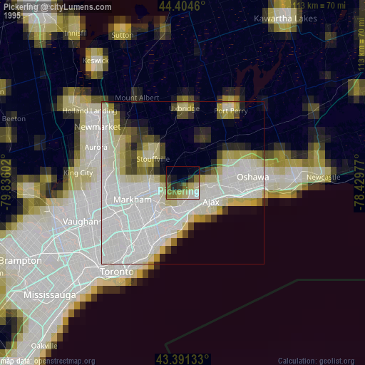
» NASA, Earths city lights 1995
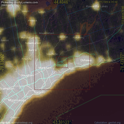
» NASA city lights 2003
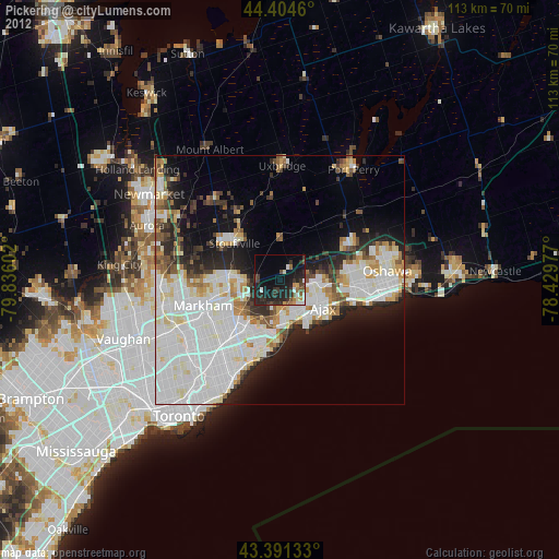
» Earth at Night: Flat Maps 2012, 2016