Peterborough night lights from space
Night Light of Peterborough (Ontario) from space (Canada) Src. Average luminocity for 10x10km area is 52.2545% and for 50x50km: 3.4274%.
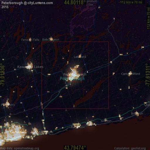
Analysis of Peterborough night lights 2016
Square area 10x10 km:
 11.52%
90-99
11.36%80-89
9.09%70-79
6.82%60-69
7.42%50-59
3.79%40-49
4.24%30-39
3.03%20-29
16.97%10-19
19.7%0-9
6.06%Square area 50x50 km:
0.46%90-99
0.52%80-89
0.5%70-79
0.42%60-69
0.4%50-59
0.35%40-49
0.55%30-39
0.29%20-29
1.11%10-19
2.69%0-9
92.71%Clear (daylight) street map image can be seen on geolist.org.
Map coordinates:
44° 48' 4.2" North, 79° 1' 9.7" West
44° 18' 0.4" North, 78° 18' 58.4" West
43° 47' 41.1" North, 77° 36' 47.2" West
Some cities around Peterborough sort by population:
• Oshawa
61.6 km =38.3 mi,  223°
223°
• Ajax
76 km =47.2 mi,  228°
228°
• Belleville
75.8 km =47.1 mi,  101°
101°
• Quinte West
61.1 km =38 mi, 102°
• Lindsay
33.6 km =20.9 mi,  279°
279°
• Cobourg
39.7 km =24.7 mi,  162°
162°
• Port Hope
32.2 km =20 mi,  191°
191°
• Uxbridge
67.5 km =41.9 mi,  250°
250°
6101645 (p: 75,877)
Sources (retrieved 2019-11-25):
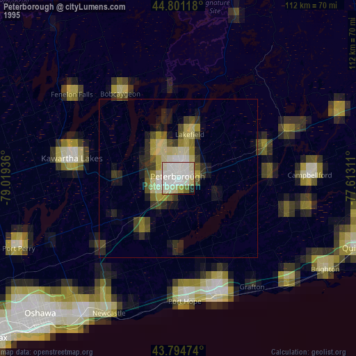
» NASA, Earths city lights 1995
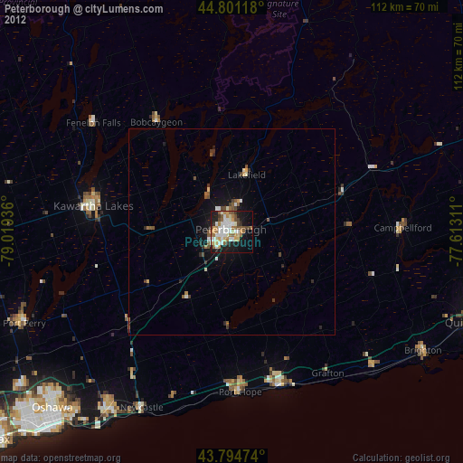
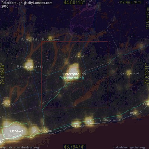
» NASA city lights 2003
» Earth at Night: Flat Maps 2012, 2016