Moncton night lights from space
Night Light of Moncton (New Brunswick) from space (Canada) Src. Average luminocity for 10x10km area is 68.0653% and for 50x50km: 5.5718%.
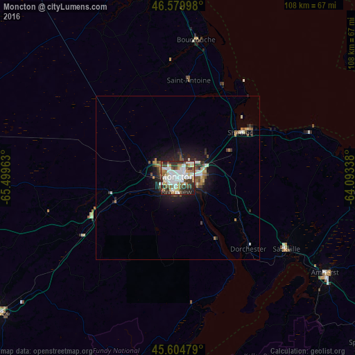
Analysis of Moncton night lights 2016
Square area 10x10 km:
 20.03%
90-99
20.88%80-89
4.83%70-79
5.11%60-69
8.52%50-59
8.95%40-49
4.83%30-39
11.08%20-29
13.21%10-19
2.56%0-9
0%Square area 50x50 km:
1.05%90-99
1.18%80-89
0.37%70-79
0.45%60-69
0.71%50-59
0.77%40-49
0.6%30-39
1.01%20-29
1.47%10-19
3.53%0-9
88.88%Clear (daylight) street map image can be seen on geolist.org.
Map coordinates:
46° 34' 47.9" North, 65° 29' 58.7" West
46° 5' 40.3" North, 64° 47' 47.4" West
45° 36' 17.2" North, 64° 5' 36.2" West
Some cities around Moncton sort by population:
• Dieppe
8.6 km =5.3 mi,  102°
102°
• Miramichi
117.1 km =72.8 mi,  332°
332°
• Lutes Mountain
9.5 km =5.9 mi,  298°
298°
• Summerside
84.5 km =52.5 mi,  66°
66°
• Kentville
115.5 km =71.8 mi,  168°
168°
• Amherst
54.6 km =33.9 mi,  122°
122°
• Greenwood
125 km =77.7 mi,  184°
184°
• Sussex
68.8 km =42.8 mi,  233°
233°
6076211 (p: 108,620)
Sources (retrieved 2019-11-25):
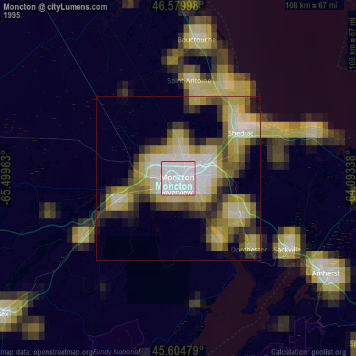
» NASA, Earths city lights 1995
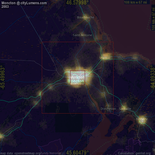
» NASA city lights 2003
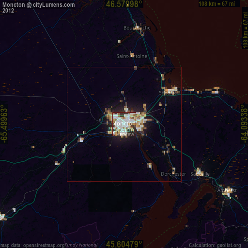
» Earth at Night: Flat Maps 2012, 2016