Lutes Mountain night lights from space
Night Light of Lutes Mountain (New Brunswick) from space (Canada) Src. Average luminocity for 10x10km area is 15.7599% and for 50x50km: 5.3867%.
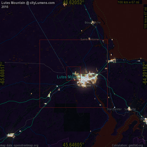
Analysis of Lutes Mountain night lights 2016
Square area 10x10 km:
 0.43%
0.43%90-99
2.27%80-89
0.57%70-79
2.56%60-69
4.26%50-59
4.12%40-49
1.99%30-39
2.84%20-29
3.13%10-19
12.93%0-9
64.91%Square area 50x50 km:
1.03%90-99
1.14%80-89
0.4%70-79
0.4%60-69
0.71%50-59
0.7%40-49
0.57%30-39
0.99%20-29
1.44%10-19
3.47%0-9
89.14%Clear (daylight) street map image can be seen on geolist.org.
Map coordinates:
46° 37' 13.9" North, 65° 36' 29.4" West
46° 8' 7.6" North, 64° 54' 18.1" West
45° 38' 45.8" North, 64° 12' 6.9" West
Some cities around Lutes Mountain sort by population:
• Moncton
9.5 km =5.9 mi,  118°
118°
• Dieppe
17.9 km =11.1 mi,  110°
110°
• Miramichi
109.3 km =67.9 mi,  335°
335°
• Summerside
90.6 km =56.3 mi,  71°
71°
• Kentville
121.9 km =75.7 mi,  164°
164°
• Amherst
64.1 km =39.8 mi, 121°
• Oromocto
126.1 km =78.4 mi,  254°
254°
• Sussex
65.4 km =40.6 mi,  225°
225°
6062163 (p: 16,311)
Sources (retrieved 2019-11-25):
» Earth at Night: Flat Maps 2012, 2016