Kincardine night lights from space
Night Light of Kincardine (Ontario) from space (Canada) Src. Average luminocity for 10x10km area is 10.6303% and for 50x50km: 0.9256%.
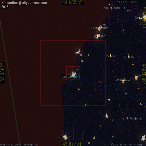
Analysis of Kincardine night lights 2016
Square area 10x10 km:
 0.3%
0.3%90-99
1.52%80-89
2.58%70-79
0.76%60-69
0.91%50-59
2.58%40-49
2.12%30-39
0.91%20-29
2.88%10-19
0%0-9
85.45%Square area 50x50 km:
0.02%90-99
0.1%80-89
0.15%70-79
0.12%60-69
0.09%50-59
0.27%40-49
0.14%30-39
0.15%20-29
0.22%10-19
0.07%0-9
98.67%Clear (daylight) street map image can be seen on geolist.org.
Map coordinates:
44° 41' 7.6" North, 82° 20' 10.3" West
44° 11' 0.2" North, 81° 37' 59.1" West
43° 40' 37.2" North, 80° 55' 47.8" West
Some cities around Kincardine sort by population:
• Owen Sound
69.5 km =43.2 mi,  52°
52°
• North Perth
73.7 km =45.8 mi,  133°
133°
• South Huron
96.8 km =60.1 mi,  174°
174°
• Huron East
68.4 km =42.5 mi,  157°
157°
• Goderich
49.5 km =30.8 mi,  187°
187°
• Listowel
74.1 km =46 mi, 132°
• Hanover
48 km =29.8 mi,  94°
94°
• Bluewater
79.7 km =49.5 mi,  178°
178°
5992144 (p: 6,725)
Sources (retrieved 2019-11-25):
» Earth at Night: Flat Maps 2012, 2016