Huron East night lights from space
Night Light of Huron East (Ontario) from space (Canada) Src. Average luminocity for 10x10km area is 0% and for 50x50km: 0.9077%.
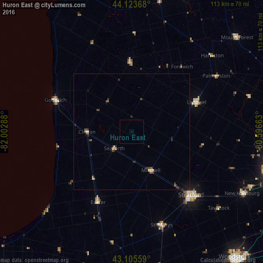
Analysis of Huron East night lights 2016
Square area 10x10 km:
 0%
0%90-99
0%80-89
0%70-79
0%60-69
0%50-59
0%40-49
0%30-39
0%20-29
0%10-19
0%0-9
100%Square area 50x50 km:
0.03%90-99
0.1%80-89
0.04%70-79
0.12%60-69
0.1%50-59
0.19%40-49
0.24%30-39
0.28%20-29
0.23%10-19
0.37%0-9
98.28%Clear (daylight) street map image can be seen on geolist.org.
Map coordinates:
44° 7' 25.2" North, 82° 0' 10.4" West
43° 37' 0.4" North, 81° 17' 59.1" West
43° 6' 20.1" North, 80° 35' 47.9" West
Some cities around Huron East sort by population:
• Stratford
39.6 km =24.6 mi,  134°
134°
• New Hamburg
54.9 km =34.1 mi,  118°
118°
• North Perth
29.3 km =18.2 mi,  65°
65°
• South Huron
37.7 km =23.4 mi,  207°
207°
• Goderich
36 km =22.4 mi,  292°
292°
• Listowel
31 km =19.3 mi, 65°
• Hanover
63 km =39.1 mi,  19°
19°
• Bluewater
29.4 km =18.3 mi,  235°
235°
5978831 (p: 9,264)
Sources (retrieved 2019-11-25):
» Earth at Night: Flat Maps 2012, 2016