Bluewater night lights from space
Night Light of Bluewater (Ontario) from space (Canada) Src. Average luminocity for 10x10km area is 0.4413% and for 50x50km: 1.0181%.
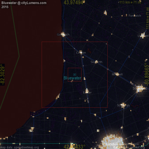
Analysis of Bluewater night lights 2016
Square area 10x10 km:
 0%
0%90-99
0%80-89
0%70-79
0%60-69
0%50-59
0%40-49
0.63%30-39
0%20-29
0.32%10-19
0.32%0-9
98.73%Square area 50x50 km:
0.06%90-99
0.13%80-89
0.11%70-79
0.19%60-69
0.08%50-59
0.21%40-49
0.2%30-39
0.16%20-29
0.35%10-19
0.15%0-9
98.35%Clear (daylight) street map image can be seen on geolist.org.
Map coordinates:
43° 58' 29.8" North, 82° 18' 10.4" West
43° 28' 0.4" North, 81° 35' 59.2" West
42° 57' 15.6" North, 80° 53' 47.9" West
Some cities around Bluewater sort by population:
• London
61.4 km =38.2 mi,  151°
151°
• Stratford
53.7 km =33.4 mi,  101°
101°
• North Perth
58.5 km =36.4 mi,  60°
60°
• Lambton Shores
42.9 km =26.7 mi,  218°
218°
• South Huron
18 km =11.2 mi,  158°
158°
• Huron East
29.4 km =18.3 mi, 55°
• Goderich
31.9 km =19.8 mi,  343°
343°
• Listowel
60.2 km =37.4 mi, 60°
5904501 (p: 7,044)
Sources (retrieved 2019-11-25):
» Earth at Night: Flat Maps 2012, 2016