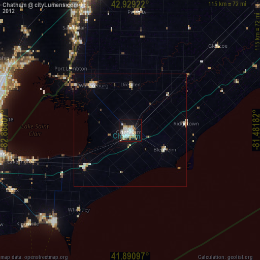
Chatham night lights from space
Night Light of Chatham (Ontario) from space (Canada) Src. Average luminocity for 10x10km area is 39.3365% and for 50x50km: 3.5624%.
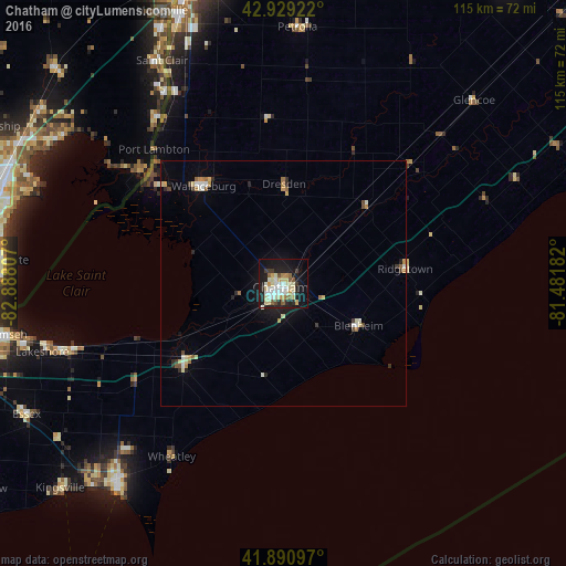
Analysis of Chatham night lights 2016
Square area 10x10 km:
 5.87%
5.87%90-99
11.27%80-89
8.57%70-79
3.17%60-69
1.9%50-59
3.81%40-49
1.9%30-39
3.33%20-29
7.94%10-19
33.49%0-9
18.73%Square area 50x50 km:
0.34%90-99
0.77%80-89
0.64%70-79
0.28%60-69
0.4%50-59
0.32%40-49
0.28%30-39
0.35%20-29
0.65%10-19
2.32%0-9
93.66%Clear (daylight) street map image can be seen on geolist.org.
Map coordinates:
42° 55' 45.2" North, 82° 53' 17.1" West
42° 24' 44.1" North, 82° 11' 5.8" West
41° 53' 27.5" North, 81° 28' 54.6" West
Some cities around Chatham sort by population:
• Saint Clair Shores, US
58.5 km =36.4 mi,  279°
279°
• Leamington
52.8 km =32.8 mi,  220°
220°
• New Baltimore, US
54.2 km =33.7 mi,  303°
303°
• Grosse Pointe Farms, US
58 km =36 mi,  269°
269°
• Essex
58.9 km =36.6 mi,  243°
243°
• Corunna
56.2 km =34.9 mi,  338°
338°
• Saint Clair, US
51.7 km =32.1 mi,  331°
331°
• Petrolia
50.6 km =31.4 mi,  3°
3°
5920457 (p: 43,550)
Sources (retrieved 2019-11-25):
» Earth at Night: Flat Maps 2012, 2016