Petrolia night lights from space
Night Light of Petrolia (Ontario) from space (Canada) Src. Average luminocity for 10x10km area is 7.4667% and for 50x50km: 7.3856%.
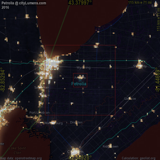
Analysis of Petrolia night lights 2016
Square area 10x10 km:
 0.63%
0.63%90-99
0.79%80-89
1.11%70-79
1.9%60-69
1.27%50-59
0.95%40-49
1.27%30-39
0.48%20-29
0.48%10-19
0.63%0-9
90.48%Square area 50x50 km:
1.57%90-99
1.77%80-89
0.75%70-79
0.47%60-69
0.92%50-59
0.84%40-49
0.79%30-39
0.83%20-29
1.97%10-19
3.53%0-9
86.54%Clear (daylight) street map image can be seen on geolist.org.
Map coordinates:
43° 22' 47.9" North, 82° 51' 10.6" West
42° 52' 0.4" North, 82° 8' 59.3" West
42° 20' 57.4" North, 81° 26' 48.1" West
Some cities around Petrolia sort by population:
• Sarnia
24.2 km =15 mi,  301°
301°
• Port Huron, US
25.2 km =15.7 mi, 297°
• Lambton Shores
37.7 km =23.4 mi,  27°
27°
• Marysville, US
27.9 km =17.3 mi,  280°
280°
• Camlachie
18.8 km =11.7 mi,  357°
357°
• Richmond, US
49.8 km =30.9 mi,  262°
262°
• Corunna
23.2 km =14.4 mi,  274°
274°
• Saint Clair, US
27.9 km =17.3 mi, 259°
6103581 (p: 5,375)
Sources (retrieved 2019-11-25):
» Earth at Night: Flat Maps 2012, 2016