Asbestos night lights from space
Night Light of Asbestos (Quebec) from space (Canada) Src. Average luminocity for 10x10km area is 10.9127% and for 50x50km: 1.8882%.
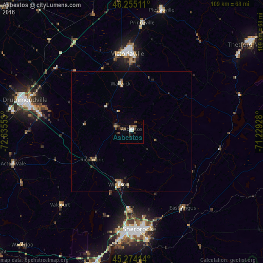
Analysis of Asbestos night lights 2016
Square area 10x10 km:
 1.11%
1.11%90-99
2.22%80-89
1.11%70-79
0.63%60-69
0.63%50-59
1.11%40-49
3.49%30-39
2.86%20-29
0.16%10-19
0%0-9
86.67%Square area 50x50 km:
0.15%90-99
0.34%80-89
0.22%70-79
0.2%60-69
0.25%50-59
0.19%40-49
0.42%30-39
0.33%20-29
0.25%10-19
0.24%0-9
97.43%Clear (daylight) street map image can be seen on geolist.org.
Map coordinates:
46° 15' 18.4" North, 72° 38' 7.9" West
45° 46' 0.4" North, 71° 55' 56.6" West
45° 16' 26.9" North, 71° 13' 45.4" West
Some cities around Asbestos sort by population:
• Sherbrooke
40.9 km =25.4 mi,  176°
176°
• Drummondville
44.5 km =27.7 mi,  286°
286°
• Rock Forest
45.8 km =28.5 mi,  186°
186°
• Victoriaville
31.6 km =19.6 mi,  355°
355°
• Plessisville
51.9 km =32.2 mi,  14°
14°
• Princeville
45.2 km =28.1 mi, 5°
• Windsor
22.8 km =14.2 mi, 193°
• Acton Vale
50.9 km =31.6 mi,  255°
255°
5887470 (p: 7,190)
Sources (retrieved 2019-11-25):
» Earth at Night: Flat Maps 2012, 2016