Plessisville night lights from space
Night Light of Plessisville (Quebec) from space (Canada) Src. Average luminocity for 10x10km area is 10.3906% and for 50x50km: 3.3326%.
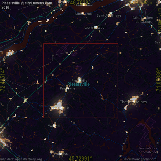
Analysis of Plessisville night lights 2016
Square area 10x10 km:
 1.28%
1.28%90-99
1.85%80-89
1.42%70-79
1.7%60-69
1.28%50-59
1.56%40-49
0%30-39
0.57%20-29
1.56%10-19
0.14%0-9
88.64%Square area 50x50 km:
0.43%90-99
0.61%80-89
0.27%70-79
0.49%60-69
0.3%50-59
0.37%40-49
0.36%30-39
0.42%20-29
1.2%10-19
2.18%0-9
93.39%Clear (daylight) street map image can be seen on geolist.org.
Map coordinates:
46° 42' 10.4" North, 72° 27' 54.5" West
46° 13' 6.8" North, 71° 45' 43.2" West
45° 43' 47.7" North, 71° 3' 32" West
Some cities around Plessisville sort by population:
• Trois-Rivières
62 km =38.5 mi,  283°
283°
• Victoriaville
24.4 km =15.2 mi,  219°
219°
• Thetford-Mines
37.8 km =23.5 mi,  111°
111°
• Bécancour
53.3 km =33.1 mi, 284°
• Pont-Rouge
59.8 km =37.2 mi,  4°
4°
• Asbestos
51.9 km =32.2 mi,  194°
194°
• Princeville
10.1 km =6.3 mi,  238°
238°
• Donnacona
51.4 km =31.9 mi, 3°
6945991 (p: 6,677)
Sources (retrieved 2019-11-25):
» Earth at Night: Flat Maps 2012, 2016