Drummondville night lights from space
Night Light of Drummondville (Quebec) from space (Canada) Src. Average luminocity for 10x10km area is 59.3646% and for 50x50km: 5.2819%.
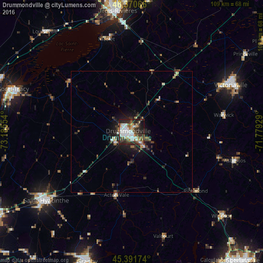

Analysis of Drummondville night lights 2016
Square area 10x10 km:
 16.52%
90-99
15.92%80-89
4.46%70-79
4.17%60-69
5.65%50-59
7.29%40-49
7.89%30-39
11.01%20-29
18.15%10-19
8.33%0-9
0.6%Square area 50x50 km:
0.79%90-99
0.95%80-89
0.32%70-79
0.39%60-69
0.69%50-59
0.65%40-49
0.79%30-39
1.15%20-29
2.31%10-19
3.09%0-9
88.87%Clear (daylight) street map image can be seen on geolist.org.
Map coordinates:
46° 22' 14.4" North, 73° 11' 7.9" West
45° 53' 0.1" North, 72° 28' 56.7" West
45° 23' 30.3" North, 71° 46' 45.4" West
Some cities around Drummondville sort by population:
• Saint-Hyacinthe
46.3 km =28.8 mi,  232°
232°
• Victoriaville
44 km =27.3 mi,  65°
65°
• Sainte-Catherine
48.8 km =30.3 mi,  352°
352°
• Bécancour
51 km =31.7 mi,  4°
4°
• Asbestos
44.5 km =27.7 mi,  106°
106°
• Nicolet
38.5 km =23.9 mi,  344°
344°
• Windsor
51.4 km =31.9 mi,  133°
133°
• Acton Vale
26.7 km =16.6 mi,  194°
194°
5942845 (p: 59,489)
Sources (retrieved 2019-11-25):
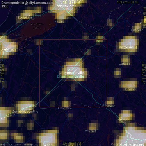
» NASA, Earths city lights 1995
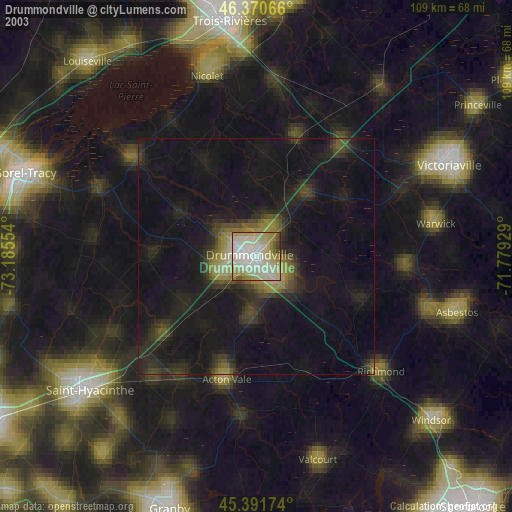
» NASA city lights 2003
» Earth at Night: Flat Maps 2012, 2016