Alliston night lights from space
Night Light of Alliston (Ontario) from space (Canada) Src. Average luminocity for 10x10km area is 23.7561% and for 50x50km: 7.7951%.
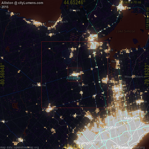
Analysis of Alliston night lights 2016
Square area 10x10 km:
 2.88%
2.88%90-99
4.39%80-89
3.79%70-79
3.18%60-69
1.06%50-59
4.7%40-49
1.36%30-39
1.52%20-29
2.42%10-19
29.7%0-9
45%Square area 50x50 km:
0.77%90-99
1.17%80-89
1.06%70-79
0.96%60-69
0.76%50-59
1.19%40-49
0.73%30-39
1.01%20-29
2.33%10-19
5.98%0-9
84.07%Clear (daylight) street map image can be seen on geolist.org.
Map coordinates:
44° 39' 8.9" North, 80° 34' 10.1" West
44° 9' 0.4" North, 79° 51' 58.9" West
43° 38' 36.4" North, 79° 9' 47.6" West
Some cities around Alliston sort by population:
• Barrie
32 km =19.9 mi,  29°
29°
• Orangeville
32 km =19.9 mi,  215°
215°
• Keswick
33.8 km =21 mi,  70°
70°
• Angus
18.6 km =11.6 mi,  355°
355°
• Shelburne
28.1 km =17.5 mi,  253°
253°
• Innisfil
24 km =14.9 mi,  45°
45°
• King
30.2 km =18.8 mi,  132°
132°
• Tottenham
14.8 km =9.2 mi,  160°
160°
5884051 (p: 18,809)
Sources (retrieved 2019-11-25):
» Earth at Night: Flat Maps 2012, 2016