Keswick night lights from space
Night Light of Keswick (Ontario) from space (Canada) Src. Average luminocity for 10x10km area is 15.1364% and for 50x50km: 12.2893%.
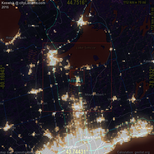
Analysis of Keswick night lights 2016
Square area 10x10 km:
 0.45%
0.45%90-99
1.67%80-89
1.67%70-79
2.88%60-69
4.09%50-59
0.76%40-49
1.52%30-39
1.21%20-29
2.42%10-19
9.39%0-9
73.94%Square area 50x50 km:
1.4%90-99
1.83%80-89
1.51%70-79
1.56%60-69
1.44%50-59
1.5%40-49
1.78%30-39
2.38%20-29
4.04%10-19
8.52%0-9
74.04%Clear (daylight) street map image can be seen on geolist.org.
Map coordinates:
44° 45' 5.8" North, 80° 10' 10" West
44° 15' 0.4" North, 79° 27' 58.8" West
43° 44' 39.5" North, 78° 45' 47.5" West
Some cities around Keswick sort by population:
• Barrie
23.1 km =14.4 mi,  316°
316°
• Newmarket
22.2 km =13.8 mi,  179°
179°
• Aurora
27.8 km =17.3 mi, 180°
• East Gwillimbury
16.7 km =10.4 mi,  172°
172°
• Alliston
33.8 km =21 mi,  250°
250°
• Uxbridge
32.5 km =20.2 mi,  120°
120°
• Innisfil
15.6 km =9.7 mi,  290°
290°
• King
33.2 km =20.6 mi,  197°
197°
5991370 (p: 21,000)
Sources (retrieved 2019-11-25):
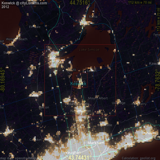
» Earth at Night: Flat Maps 2012, 2016