Orangeville night lights from space
Night Light of Orangeville (Ontario) from space (Canada) Src. Average luminocity for 10x10km area is 25.7095% and for 50x50km: 5.5265%.
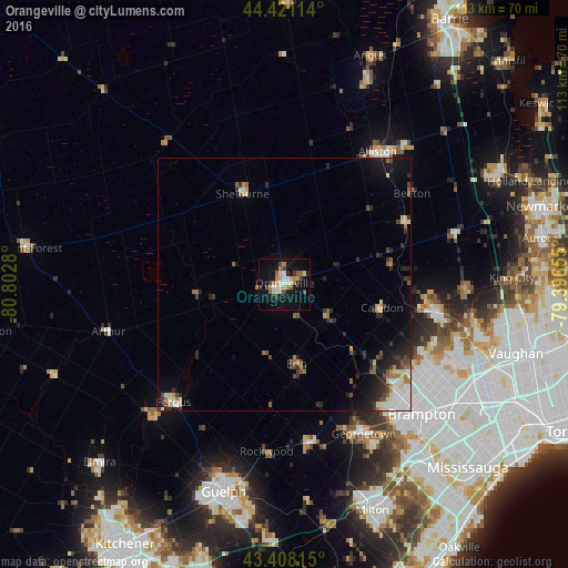
Analysis of Orangeville night lights 2016
Square area 10x10 km:
 2.86%
2.86%90-99
4.44%80-89
3.17%70-79
3.97%60-69
3.33%50-59
2.86%40-49
3.02%30-39
3.49%20-29
2.38%10-19
28.57%0-9
41.9%Square area 50x50 km:
0.76%90-99
0.8%80-89
0.66%70-79
0.46%60-69
0.61%50-59
0.69%40-49
0.85%30-39
0.91%20-29
1.74%10-19
3.44%0-9
89.08%Clear (daylight) street map image can be seen on geolist.org.
Map coordinates:
44° 25' 16.1" North, 80° 48' 10.1" West
43° 55' 0.5" North, 80° 5' 58.8" West
43° 24' 29.3" North, 79° 23' 47.6" West
Some cities around Orangeville sort by population:
• Brampton
37.3 km =23.2 mi,  134°
134°
• Guelph
43.1 km =26.8 mi,  196°
196°
• Milton
47.8 km =29.7 mi,  158°
158°
• Alliston
32 km =19.9 mi,  35°
35°
• Angus
47.7 km =29.6 mi,  21°
21°
• Shelburne
19.8 km =12.3 mi,  335°
335°
• King
41.1 km =25.5 mi,  82°
82°
• Tottenham
26.4 km =16.4 mi,  63°
63°
6094201 (p: 30,734)
Sources (retrieved 2019-11-25):
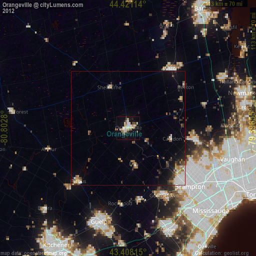
» Earth at Night: Flat Maps 2012, 2016