High Rock night lights from space
Night Light of High Rock (East Grand Bahama) from space (Bahamas) Src. Average luminocity for 10x10km area is 1.5133% and for 50x50km: 0.0861%.
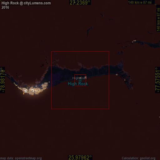
Analysis of High Rock night lights 2016
Square area 10x10 km:
 0%
0%90-99
0%80-89
0%70-79
0%60-69
0%50-59
1.52%40-49
0.19%30-39
1.33%20-29
0%10-19
0%0-9
96.97%Square area 50x50 km:
0%90-99
0%80-89
0%70-79
0%60-69
0%50-59
0.06%40-49
0.02%30-39
0.08%20-29
0.02%10-19
0.02%0-9
99.81%Clear (daylight) street map image can be seen on geolist.org.
Map coordinates:
27° 14' 12.8" North, 78° 58' 54.3" West
26° 36' 36" North, 78° 16' 43.1" West
25° 58' 46.6" North, 77° 34' 31.8" West
Some cities around High Rock sort by population:
• Lucaya
39.5 km =24.5 mi,  257°
257°
• Freeport
42.8 km =26.6 mi, 258°
• West End
69.9 km =43.4 mi,  277°
277°
• Cooper’s Town
81.5 km =50.6 mi,  69°
69°
• San Andros
173.1 km =107.6 mi,  172°
172°
• Marsh Harbour
121.1 km =75.2 mi,  93°
93°
• Alice Town
141.2 km =87.7 mi,  226°
226°
• Hard Bargain
78 km =48.5 mi,  114°
114°
3572189 (p: 3,744)
Sources (retrieved 2019-11-25):
» Earth at Night: Flat Maps 2012, 2016