Viradouro night lights from space
Night Light of Viradouro (São Paulo) from space (Brazil) Src. Average luminocity for 10x10km area is 8.8948% and for 50x50km: 3.9977%.
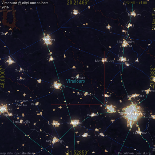
Analysis of Viradouro night lights 2016
Square area 10x10 km:
 0.6%
0.6%90-99
2.18%80-89
0.4%70-79
0.79%60-69
1.59%50-59
0.79%40-49
2.18%30-39
2.78%20-29
0.6%10-19
0%0-9
88.1%Square area 50x50 km:
0.39%90-99
0.48%80-89
0.52%70-79
0.77%60-69
0.62%50-59
0.3%40-49
0.64%30-39
0.49%20-29
0.39%10-19
2.14%0-9
93.26%Clear (daylight) street map image can be seen on geolist.org.
Map coordinates:
20° 12' 52.8" South, 49° 0' 0.3" West
20° 52' 23" South, 48° 17' 49" West
21° 31' 42.9" South, 47° 35' 37.8" West
Some cities around Viradouro sort by population:
• Sertãozinho
43.4 km =27 mi,  132°
132°
• Bebedouro
20.7 km =12.9 mi,  245°
245°
• Jaboticabal
42.5 km =26.4 mi,  183°
183°
• Pontal
31.7 km =19.7 mi,  121°
121°
• Pitangueiras
17.1 km =10.6 mi,  152°
152°
• Barrinha
38.2 km =23.7 mi,  158°
158°
• Morro Agudo
29.4 km =18.3 mi,  57°
57°
• Monte Azul Paulista
36 km =22.4 mi,  263°
263°
3444997 (p: 17,172)
Sources (retrieved 2019-11-25):
» Earth at Night: Flat Maps 2012, 2016