Bebedouro night lights from space
Night Light of Bebedouro (São Paulo) from space (Brazil) Src. Average luminocity for 10x10km area is 37.7123% and for 50x50km: 4.0419%.
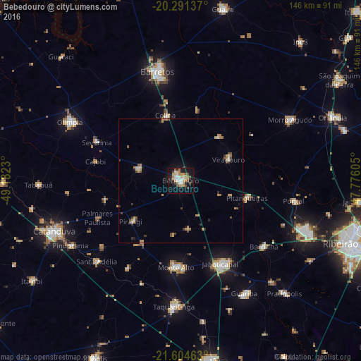
Analysis of Bebedouro night lights 2016
Square area 10x10 km:
 5.56%
5.56%90-99
7.14%80-89
4.96%70-79
6.94%60-69
5.36%50-59
2.78%40-49
6.75%30-39
1.79%20-29
4.56%10-19
38.29%0-9
15.87%Square area 50x50 km:
0.35%90-99
0.5%80-89
0.48%70-79
0.81%60-69
0.58%50-59
0.3%40-49
0.68%30-39
0.64%20-29
0.47%10-19
2.15%0-9
93.06%Clear (daylight) street map image can be seen on geolist.org.
Map coordinates:
20° 17' 28.9" South, 49° 10' 56.3" West
20° 56' 58" South, 48° 28' 45" West
21° 36' 16.7" South, 47° 46' 33.8" West
Some cities around Bebedouro sort by population:
• Barretos
44.6 km =27.7 mi,  348°
348°
• Jaboticabal
37.6 km =23.4 mi,  154°
154°
• Monte Alto
34.7 km =21.6 mi,  182°
182°
• Pitangueiras
27.6 km =17.1 mi,  104°
104°
• Barrinha
42.5 km =26.4 mi,  129°
129°
• Monte Azul Paulista
17.5 km =10.9 mi,  285°
285°
• Viradouro
20.7 km =12.9 mi,  65°
65°
• Severínia
37 km =23 mi, 294°
3470264 (p: 71,862)
Sources (retrieved 2019-11-25):
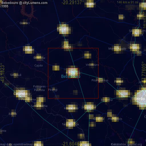
» NASA, Earths city lights 1995
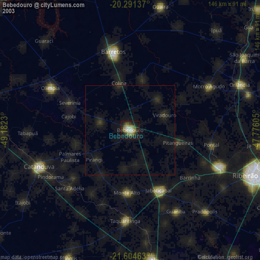
» NASA city lights 2003
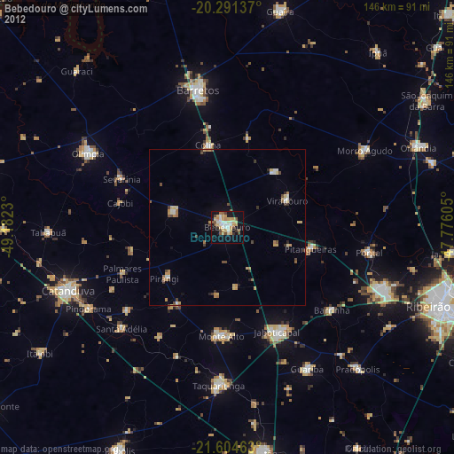
» Earth at Night: Flat Maps 2012, 2016