Sertãozinho night lights from space
Night Light of Sertãozinho (São Paulo) from space (Brazil) Src. Average luminocity for 10x10km area is 54.9841% and for 50x50km: 17.0288%.
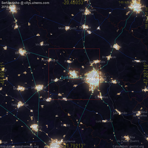
Analysis of Sertãozinho night lights 2016
Square area 10x10 km:
 14.29%
90-99
10.52%80-89
7.54%70-79
6.94%60-69
5.16%50-59
3.57%40-49
8.53%30-39
9.33%20-29
16.47%10-19
17.66%0-9
0%Square area 50x50 km:
4.27%90-99
3.05%80-89
1.21%70-79
2.4%60-69
2.09%50-59
1.43%40-49
2.1%30-39
1.6%20-29
3.84%10-19
9.17%0-9
68.82%Clear (daylight) street map image can be seen on geolist.org.
Map coordinates:
20° 28' 49.9" South, 48° 41' 36.3" West
21° 8' 16" South, 47° 59' 25" West
21° 47' 31.7" South, 47° 17' 13.8" West
Some cities around Sertãozinho sort by population:
• Ribeirão Preto
19.2 km =11.9 mi,  103°
103°
• Jardinópolis
27 km =16.8 mi,  60°
60°
• Cravinhos
35.2 km =21.9 mi,  129°
129°
• Pontal
13.7 km =8.5 mi,  339°
339°
• Guariba
34.9 km =21.7 mi,  224°
224°
• Pitangueiras
27.9 km =17.3 mi,  300°
300°
• Barrinha
19 km =11.8 mi,  250°
250°
• Pradópolis
25.9 km =16.1 mi,  197°
197°
3447651 (p: 99,211)
Sources (retrieved 2019-11-25):
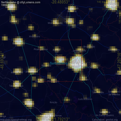
» NASA, Earths city lights 1995
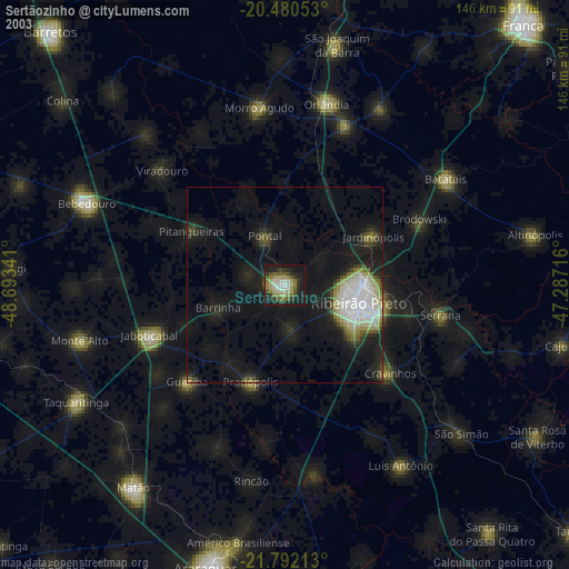
» NASA city lights 2003
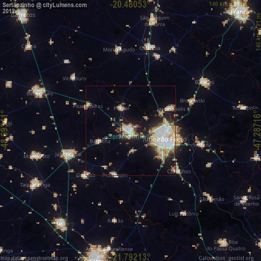
» Earth at Night: Flat Maps 2012, 2016