Jaboticabal night lights from space
Night Light of Jaboticabal (São Paulo) from space (Brazil) Src. Average luminocity for 10x10km area is 43.6786% and for 50x50km: 7.8015%.
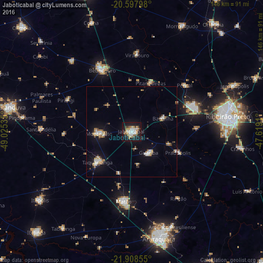

Analysis of Jaboticabal night lights 2016
Square area 10x10 km:
 7.74%
7.74%90-99
11.31%80-89
3.37%70-79
8.53%60-69
2.78%50-59
5.16%40-49
3.97%30-39
3.17%20-29
8.33%10-19
40.28%0-9
5.36%Square area 50x50 km:
1.02%90-99
1.19%80-89
0.83%70-79
1.06%60-69
0.88%50-59
0.76%40-49
0.8%30-39
0.89%20-29
0.89%10-19
6.15%0-9
85.54%Clear (daylight) street map image can be seen on geolist.org.
Map coordinates:
20° 35' 52.7" South, 49° 1' 31.3" West
21° 15' 17" South, 48° 19' 20" West
21° 54' 30.8" South, 47° 37' 8.8" West
Some cities around Jaboticabal sort by population:
• Sertãozinho
36.8 km =22.9 mi,  69°
69°
• Bebedouro
37.6 km =23.4 mi,  334°
334°
• Taquaritinga
25.3 km =15.7 mi,  228°
228°
• Monte Alto
18.1 km =11.2 mi,  267°
267°
• Guariba
15.2 km =9.4 mi,  140°
140°
• Pitangueiras
29.2 km =18.1 mi,  20°
20°
• Barrinha
17.8 km =11.1 mi, 67°
• Pradópolis
29 km =18 mi,  113°
113°
3460441 (p: 69,394)
Sources (retrieved 2019-11-25):
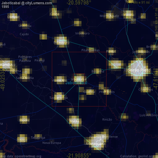
» NASA, Earths city lights 1995
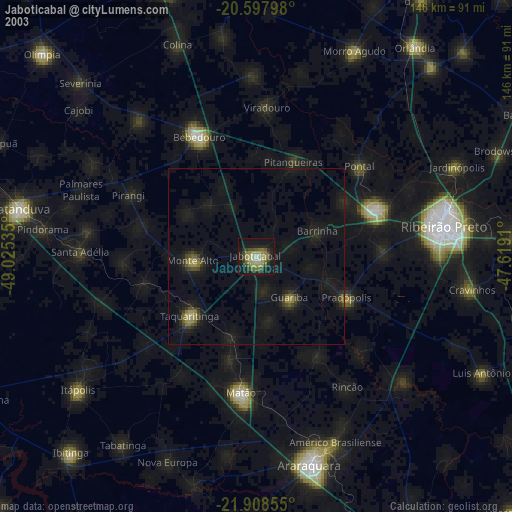
» NASA city lights 2003
» Earth at Night: Flat Maps 2012, 2016