Monte Azul Paulista night lights from space
Night Light of Monte Azul Paulista (São Paulo) from space (Brazil) Src. Average luminocity for 10x10km area is 9.369% and for 50x50km: 4.3785%.
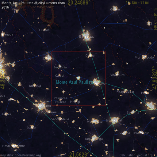
Analysis of Monte Azul Paulista night lights 2016
Square area 10x10 km:
 1.19%
1.19%90-99
1.98%80-89
1.39%70-79
1.19%60-69
1.39%50-59
0.99%40-49
1.19%30-39
0.2%20-29
1.19%10-19
0.4%0-9
88.89%Square area 50x50 km:
0.44%90-99
0.5%80-89
0.5%70-79
0.84%60-69
0.67%50-59
0.38%40-49
0.72%30-39
0.47%20-29
0.62%10-19
2.42%0-9
92.46%Clear (daylight) street map image can be seen on geolist.org.
Map coordinates:
20° 14' 56.3" South, 49° 20' 40.3" West
20° 54' 26" South, 48° 38' 29" West
21° 33' 45.4" South, 47° 56' 17.8" West
Some cities around Monte Azul Paulista sort by population:
• Catanduva
42.9 km =26.7 mi,  233°
233°
• Barretos
39.7 km =24.7 mi,  11°
11°
• Bebedouro
17.5 km =10.9 mi,  105°
105°
• Olímpia
34.1 km =21.2 mi,  303°
303°
• Viradouro
36 km =22.4 mi,  83°
83°
• Severínia
20 km =12.4 mi, 302°
• Santa Adélia
41 km =25.5 mi,  204°
204°
• Pindorama
41.5 km =25.8 mi,  221°
221°
3456863 (p: 18,117)
Sources (retrieved 2019-11-25):
» Earth at Night: Flat Maps 2012, 2016