Viçosa night lights from space
Night Light of Viçosa (Minas Gerais) from space (Brazil) Src. Average luminocity for 10x10km area is 36.5985% and for 50x50km: 4.4717%.
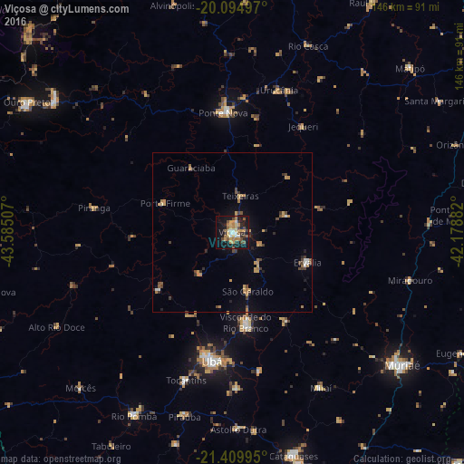
Analysis of Viçosa night lights 2016
Square area 10x10 km:
 3.79%
3.79%90-99
3.03%80-89
5.49%70-79
8.71%60-69
7.2%50-59
5.49%40-49
5.11%30-39
4.36%20-29
5.49%10-19
36.55%0-9
14.77%Square area 50x50 km:
0.3%90-99
0.24%80-89
0.42%70-79
1.13%60-69
0.92%50-59
0.45%40-49
0.85%30-39
0.68%20-29
0.58%10-19
2.66%0-9
91.77%Clear (daylight) street map image can be seen on geolist.org.
Map coordinates:
20° 5' 41.9" South, 43° 35' 6.3" West
20° 45' 14" South, 42° 52' 55" West
21° 24' 35.8" South, 42° 10' 43.8" West
Some cities around Viçosa sort by population:
• Ubá
41.2 km =25.6 mi,  188°
188°
• Ponte Nova
37.6 km =23.4 mi,  355°
355°
• Visconde do Rio Branco
28.8 km =17.9 mi,  171°
171°
• Rio Pomba
65.6 km =40.8 mi,  208°
208°
• Tocantins
48.9 km =30.4 mi,  196°
196°
• Rio Casca
63.4 km =39.4 mi,  22°
22°
• Astolfo Dutra
62.5 km =38.8 mi,  178°
178°
• Miraí
56.4 km =35 mi,  150°
150°
3445133 (p: 68,680)
Sources (retrieved 2019-11-25):
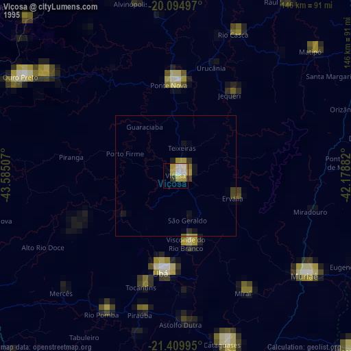
» NASA, Earths city lights 1995
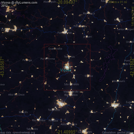
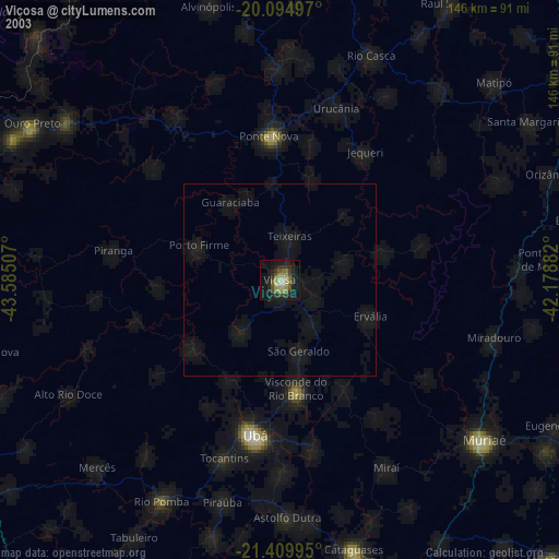
» NASA city lights 2003
» Earth at Night: Flat Maps 2012, 2016