Vespasiano night lights from space
Night Light of Vespasiano (Minas Gerais) from space (Brazil) Src. Average luminocity for 10x10km area is 67.188% and for 50x50km: 39.8232%.
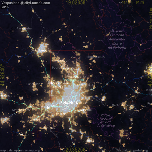
Analysis of Vespasiano night lights 2016
Square area 10x10 km:
 4.55%
4.55%90-99
8.47%80-89
10.12%70-79
23.97%60-69
18.18%50-59
16.32%40-49
11.16%30-39
7.02%20-29
0.21%10-19
0%0-9
0%Square area 50x50 km:
9.12%90-99
5.46%80-89
3.64%70-79
11.31%60-69
6.25%50-59
4.82%40-49
4.74%30-39
3.34%20-29
6.03%10-19
10.75%0-9
34.55%Clear (daylight) street map image can be seen on geolist.org.
Map coordinates:
19° 1' 42.9" South, 44° 37' 35.3" West
19° 41' 31" South, 43° 55' 24" West
20° 21' 9.2" South, 43° 13' 12.8" West
Some cities around Vespasiano sort by population:
• Belo Horizonte
25.5 km =15.8 mi,  183°
183°
• Contagem
29.9 km =18.6 mi,  207°
207°
• Ribeirão das Neves
19 km =11.8 mi,  243°
243°
• Santa Luzia
11.5 km =7.1 mi,  138°
138°
• Pedro Leopoldo
15 km =9.3 mi,  303°
303°
• Lagoa Santa
7.3 km =4.5 mi,  18°
18°
• Matozinhos
22.3 km =13.9 mi,  312°
312°
• Raposos
33 km =20.5 mi,  157°
157°
3445162 (p: 94,749)
Sources (retrieved 2019-11-25):
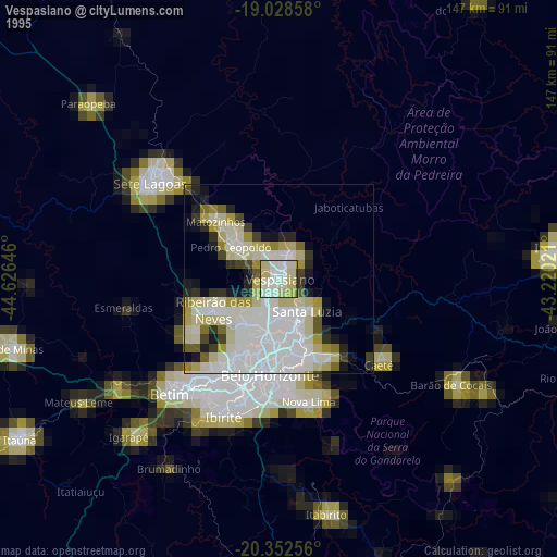
» NASA, Earths city lights 1995
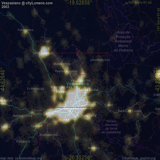
» NASA city lights 2003
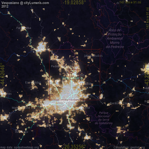
» Earth at Night: Flat Maps 2012, 2016