Pedro Leopoldo night lights from space
Night Light of Pedro Leopoldo (Minas Gerais) from space (Brazil) Src. Average luminocity for 10x10km area is 50.4132% and for 50x50km: 34.5671%.
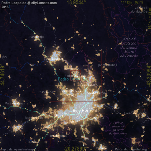
Analysis of Pedro Leopoldo night lights 2016
Square area 10x10 km:
 2.89%
2.89%90-99
2.89%80-89
5.58%70-79
22.73%60-69
11.16%50-59
3.1%40-49
11.36%30-39
8.06%20-29
19.01%10-19
11.57%0-9
1.65%Square area 50x50 km:
4.93%90-99
4.84%80-89
3.24%70-79
10.56%60-69
5.89%50-59
4.44%40-49
4.87%30-39
3.63%20-29
7.6%10-19
12.49%0-9
37.51%Clear (daylight) street map image can be seen on geolist.org.
Map coordinates:
18° 57' 15.8" South, 44° 44' 46.3" West
19° 37' 5" South, 44° 2' 35" West
20° 16' 44.4" South, 43° 20' 23.8" West
Some cities around Pedro Leopoldo sort by population:
• Contagem
34.9 km =21.7 mi,  181°
181°
• Ribeirão das Neves
17.2 km =10.7 mi,  195°
195°
• Santa Luzia
26.2 km =16.3 mi,  130°
130°
• Sete Lagoas
27.2 km =16.9 mi,  308°
308°
• Esmeraldas
32.6 km =20.3 mi,  240°
240°
• Vespasiano
15 km =9.3 mi,  123°
123°
• Lagoa Santa
14.9 km =9.3 mi,  95°
95°
• Matozinhos
7.8 km =4.8 mi,  329°
329°
3454358 (p: 49,261)
Sources (retrieved 2019-11-25):
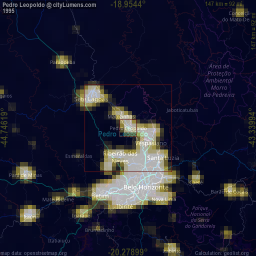
» NASA, Earths city lights 1995
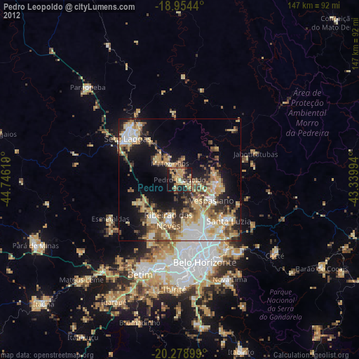
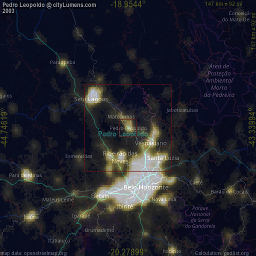
» NASA city lights 2003
» Earth at Night: Flat Maps 2012, 2016