Contagem night lights from space
Night Light of Contagem (Minas Gerais) from space (Brazil) Src. Average luminocity for 10x10km area is 97.4784% and for 50x50km: 55.9766%.
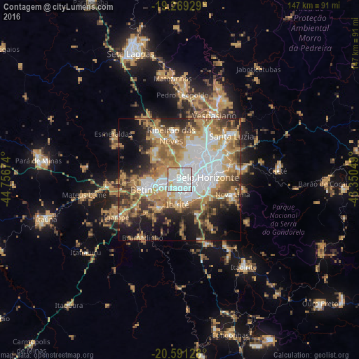
Analysis of Contagem night lights 2016
Square area 10x10 km:
 62.55%
90-99
27.06%80-89
8.01%70-79
2.38%60-69
0%50-59
0%40-49
0%30-39
0%20-29
0%10-19
0%0-9
0%Square area 50x50 km:
15.76%90-99
8.26%80-89
4.75%70-79
13.22%60-69
8.78%50-59
6.44%40-49
7.35%30-39
5.76%20-29
6.86%10-19
11.31%0-9
11.5%Clear (daylight) street map image can be seen on geolist.org.
Map coordinates:
19° 16' 9.4" South, 44° 45' 24.3" West
19° 55' 54" South, 44° 3' 13" West
20° 35' 28.6" South, 43° 21' 1.8" West
Some cities around Contagem sort by population:
• Belo Horizonte
12.2 km =7.6 mi,  84°
84°
• Ribeirão das Neves
18.6 km =11.6 mi,  349°
349°
• Betim
15.6 km =9.7 mi,  255°
255°
• Ibirité
10.1 km =6.3 mi,  183°
183°
• Nova Lima
22.4 km =13.9 mi,  105°
105°
• Sarzedo
14.9 km =9.3 mi,  219°
219°
• São Joaquim de Bicas
26.5 km =16.5 mi,  240°
240°
• Raposos
26.4 km =16.4 mi,  98°
98°
3465624 (p: 627,123)
Sources (retrieved 2019-11-25):
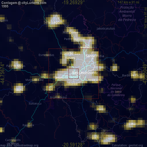
» NASA, Earths city lights 1995
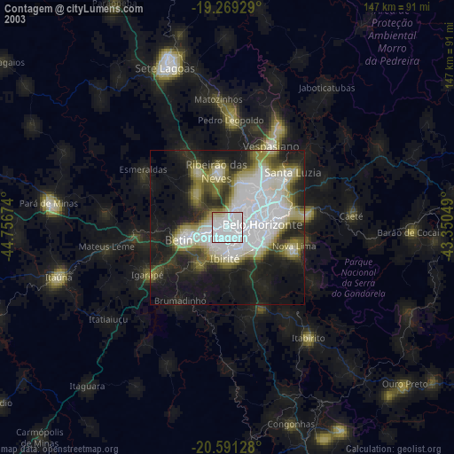
» NASA city lights 2003
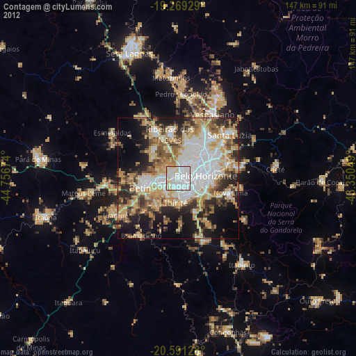
» Earth at Night: Flat Maps 2012, 2016