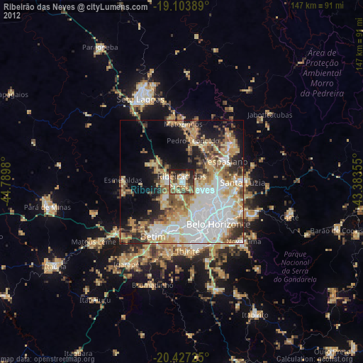
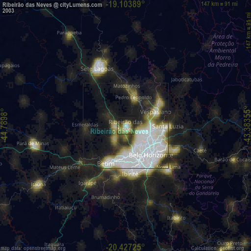
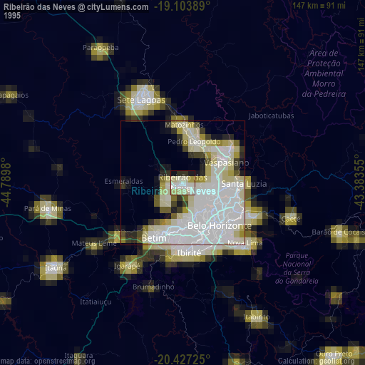
Ribeirão das Neves night lights from space
Night Light of Ribeirão das Neves (Minas Gerais) from space (Brazil) Src. Average luminocity for 10x10km area is 63.7831% and for 50x50km: 51.3653%.

Analysis of Ribeirão das Neves night lights 2016
Square area 10x10 km:
 5.37%
5.37%90-99
10.12%80-89
6.82%70-79
21.07%60-69
15.5%50-59
14.88%40-49
10.12%30-39
4.55%20-29
11.57%10-19
0%0-9
0%Square area 50x50 km:
15.24%90-99
7.78%80-89
4.35%70-79
13.05%60-69
7.6%50-59
5.45%40-49
5.44%30-39
3.4%20-29
6.55%10-19
8.94%0-9
22.19%Clear (daylight) street map image can be seen on geolist.org.
Map coordinates:
19° 6' 14" South, 44° 47' 23.3" West
19° 46' 1" South, 44° 5' 12" West
20° 25' 38.1" South, 43° 23' 0.8" West
Some cities around Ribeirão das Neves sort by population:
• Belo Horizonte
23.1 km =14.4 mi,  137°
137°
• Contagem
18.6 km =11.6 mi,  169°
169°
• Santa Luzia
24.6 km =15.3 mi,  90°
90°
• Esmeraldas
23.8 km =14.8 mi,  271°
271°
• Vespasiano
19 km =11.8 mi,  63°
63°
• Pedro Leopoldo
17.2 km =10.7 mi,  15°
15°
• Lagoa Santa
24.7 km =15.3 mi,  51°
51°
• Matozinhos
23.3 km =14.5 mi,  1°
1°
3451353 (p: 406,802)
Sources (retrieved 2019-11-25):
» NASA, Earths city lights 1995
» NASA city lights 2003
» Earth at Night: Flat Maps 2012, 2016