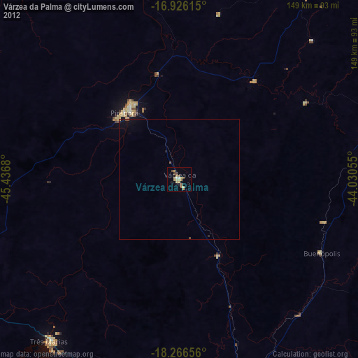
Várzea da Palma night lights from space
Night Light of Várzea da Palma (Minas Gerais) from space (Brazil) Src. Average luminocity for 10x10km area is 17.3037% and for 50x50km: 1.0225%.
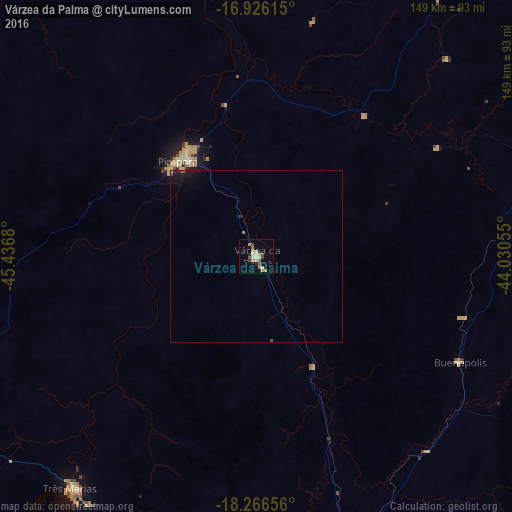
Analysis of Várzea da Palma night lights 2016
Square area 10x10 km:
 1.86%
1.86%90-99
2.07%80-89
2.07%70-79
5.58%60-69
0.83%50-59
2.48%40-49
2.48%30-39
1.65%20-29
0.83%10-19
1.24%0-9
78.93%Square area 50x50 km:
0.07%90-99
0.08%80-89
0.11%70-79
0.22%60-69
0.1%50-59
0.1%40-49
0.16%30-39
0.1%20-29
0.11%10-19
0.71%0-9
98.25%Clear (daylight) street map image can be seen on geolist.org.
Map coordinates:
16° 55' 34.1" South, 45° 26' 12.5" West
17° 35' 51.4" South, 44° 44' 1.2" West
18° 15' 59.6" South, 44° 1' 50" West
Some cities around Várzea da Palma sort by population:
• Montes Claros
133.3 km =82.8 mi,  44°
44°
• Curvelo
132.8 km =82.5 mi,  166°
166°
• Pirapora
35.7 km =22.2 mi,  321°
321°
• Diamantina
139.7 km =86.8 mi,  121°
121°
• Bocaiúva
111.7 km =69.4 mi,  60°
60°
• Buritizeiro
36.6 km =22.7 mi, 318°
• Corinto
91.9 km =57.1 mi,  161°
161°
• Coração de Jesus
108.7 km =67.5 mi,  21°
21°
3445459 (p: 28,706)
Sources (retrieved 2019-11-25):
» Earth at Night: Flat Maps 2012, 2016