Coração de Jesus night lights from space
Night Light of Coração de Jesus (Minas Gerais) from space (Brazil) Src. Average luminocity for 10x10km area is 7.29% and for 50x50km: 0.4728%.
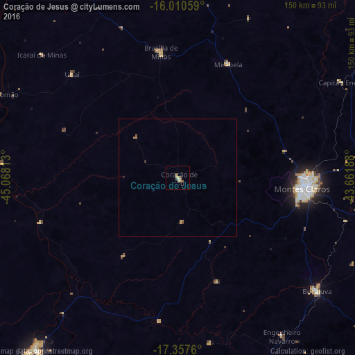
Analysis of Coração de Jesus night lights 2016
Square area 10x10 km:
 0.22%
0.22%90-99
0.65%80-89
2.16%70-79
2.6%60-69
1.3%50-59
0%40-49
1.73%30-39
0%20-29
0%10-19
0%0-9
91.34%Square area 50x50 km:
0.01%90-99
0.03%80-89
0.09%70-79
0.22%60-69
0.08%50-59
0.02%40-49
0.13%30-39
0.03%20-29
0.03%10-19
0.03%0-9
99.33%Clear (daylight) street map image can be seen on geolist.org.
Map coordinates:
16° 0' 38.1" South, 45° 4' 5.3" West
16° 41' 7" South, 44° 21' 54" West
17° 21' 27.4" South, 43° 39' 42.8" West
Some cities around Coração de Jesus sort by population:
• Montes Claros
53.9 km =33.5 mi,  95°
95°
• Pirapora
95.6 km =59.4 mi,  219°
219°
• Bocaiúva
75 km =46.6 mi,  128°
128°
• Buritizeiro
97.5 km =60.6 mi, 220°
• Brasília de Minas
53.7 km =33.4 mi,  352°
352°
• Francisco Sá
96.3 km =59.8 mi,  76°
76°
• Mirabela
51.6 km =32.1 mi,  24°
24°
• São João da Ponte
92.3 km =57.4 mi, 24°
3465542 (p: 12,410)
Sources (retrieved 2019-11-25):
» Earth at Night: Flat Maps 2012, 2016