Indaiatuba night lights from space
Night Light of Indaiatuba (São Paulo) from space (Brazil) Src. Average luminocity for 10x10km area is 78.5625% and for 50x50km: 45.7556%.
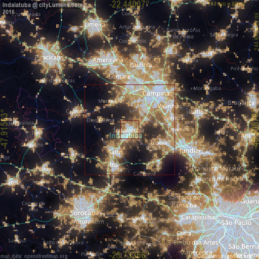

Analysis of Indaiatuba night lights 2016
Square area 10x10 km:
 16.1%
16.1%90-99
17.8%80-89
15.15%70-79
18.56%60-69
18.56%50-59
8.52%40-49
3.22%30-39
1.7%20-29
0.38%10-19
0%0-9
0%Square area 50x50 km:
7.37%90-99
7.53%80-89
7.02%70-79
9.72%60-69
8.34%50-59
6.65%40-49
5.69%30-39
5.3%20-29
8.76%10-19
12.98%0-9
20.66%Clear (daylight) street map image can be seen on geolist.org.
Map coordinates:
22° 26' 24.3" South, 47° 54' 54.1" West
23° 5' 18.3" South, 47° 12' 42.8" West
23° 44' 1.2" South, 46° 30' 31.6" West
Some cities around Indaiatuba sort by population:
• Campinas
25.5 km =15.8 mi,  37°
37°
• Hortolândia
25.6 km =15.9 mi,  358°
358°
• Itu
21.5 km =13.4 mi,  204°
204°
• Salto
14.7 km =9.1 mi,  211°
211°
• Vinhedo
25.1 km =15.6 mi,  74°
74°
• Monte Mor
19 km =11.8 mi,  325°
325°
• Itupeva
17.3 km =10.7 mi,  114°
114°
• Elias Fausto
17.3 km =10.7 mi,  287°
287°
3461311 (p: 179,911)
Sources (retrieved 2019-11-25):
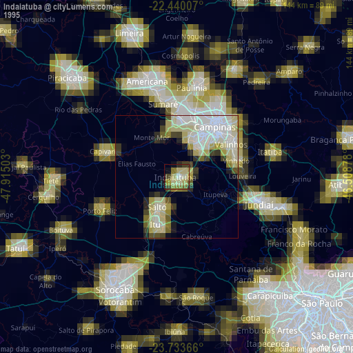
» NASA, Earths city lights 1995
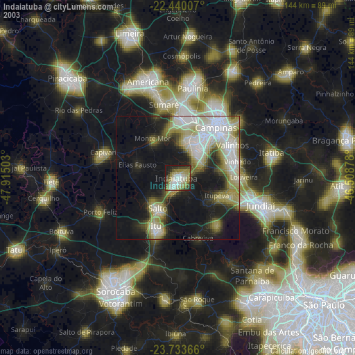
» NASA city lights 2003
» Earth at Night: Flat Maps 2012, 2016