Umirim night lights from space
Night Light of Umirim (Ceará) from space (Brazil) Src. Average luminocity for 10x10km area is 7.1364% and for 50x50km: 4.6907%.
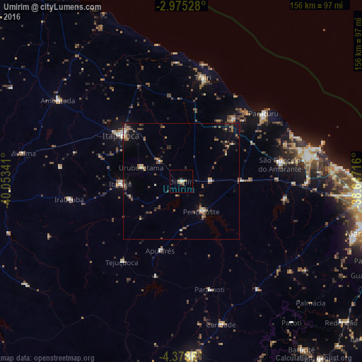
Analysis of Umirim night lights 2016
Square area 10x10 km:
 0%
0%90-99
1.73%80-89
0%70-79
2.38%60-69
0.22%50-59
1.73%40-49
0.87%30-39
0.22%20-29
2.6%10-19
0.65%0-9
89.61%Square area 50x50 km:
0.1%90-99
0.5%80-89
0.44%70-79
0.45%60-69
0.75%50-59
1.17%40-49
1.11%30-39
0.88%20-29
1.05%10-19
1.64%0-9
91.92%Clear (daylight) street map image can be seen on geolist.org.
Map coordinates:
2° 58' 31" South, 40° 3' 12.3" West
3° 40' 38" South, 39° 21' 1" West
4° 22' 43" South, 38° 38' 49.8" West
Some cities around Umirim sort by population:
• Itapipoca
32.5 km =20.2 mi,  308°
308°
• Itapagé
26.2 km =16.3 mi,  267°
267°
• São Gonçalo do Amarante
43.1 km =26.8 mi,  79°
79°
• Trairi
45.3 km =28.1 mi,  11°
11°
• Pentecoste
15.6 km =9.7 mi,  145°
145°
• Paraipaba
34.7 km =21.6 mi,  40°
40°
• Uruburetama
18.5 km =11.5 mi,  288°
288°
• Jardim
40.3 km =25 mi,  54°
54°
3385758 (p: 12,220)
Sources (retrieved 2019-11-25):
» Earth at Night: Flat Maps 2012, 2016