Paraipaba night lights from space
Night Light of Paraipaba (Ceará) from space (Brazil) Src. Average luminocity for 10x10km area is 26.5823% and for 50x50km: 7.2802%.
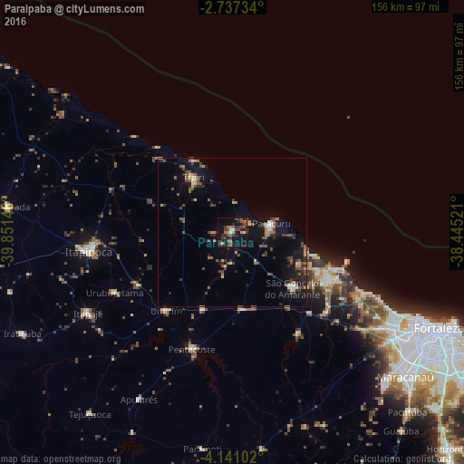
Analysis of Paraipaba night lights 2016
Square area 10x10 km:
 0.43%
0.43%90-99
3.03%80-89
0.87%70-79
1.95%60-69
5.84%50-59
6.93%40-49
6.28%30-39
10.17%20-29
6.28%10-19
28.79%0-9
29.44%Square area 50x50 km:
0.18%90-99
0.81%80-89
0.48%70-79
0.68%60-69
1.03%50-59
1.73%40-49
1.59%30-39
1.47%20-29
1.64%10-19
6.19%0-9
84.18%Clear (daylight) street map image can be seen on geolist.org.
Map coordinates:
2° 44' 14.4" South, 39° 51' 5.3" West
3° 26' 22" South, 39° 8' 54" West
4° 8' 27.7" South, 38° 26' 42.8" West
Some cities around Paraipaba sort by population:
• São Gonçalo do Amarante
27.3 km =17 mi,  133°
133°
• Trairi
22.4 km =13.9 mi,  323°
323°
• Paracuru
13.5 km =8.4 mi,  75°
75°
• Pentecoste
41.6 km =25.8 mi,  199°
199°
• Umirim
34.7 km =21.6 mi,  220°
220°
• Uruburetama
45 km =28 mi,  242°
242°
• Jardim
10.5 km =6.5 mi,  105°
105°
• Cambebba
40.8 km =25.4 mi,  119°
119°
3393091 (p: 18,423)
Sources (retrieved 2019-11-25):
» Earth at Night: Flat Maps 2012, 2016