Turiaçu night lights from space
Night Light of Turiaçu (Maranhão) from space (Brazil) Src. Average luminocity for 10x10km area is 5.3766% and for 50x50km: 0.3316%.
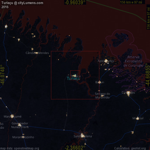
Analysis of Turiaçu night lights 2016
Square area 10x10 km:
 0%
0%90-99
0%80-89
1.95%70-79
1.52%60-69
0.87%50-59
1.52%40-49
0.22%30-39
0%20-29
0%10-19
1.73%0-9
92.21%Square area 50x50 km:
0%90-99
0%80-89
0.08%70-79
0.06%60-69
0.07%50-59
0.1%40-49
0.1%30-39
0.01%20-29
0.03%10-19
0.07%0-9
99.48%Clear (daylight) street map image can be seen on geolist.org.
Map coordinates:
0° 57' 37.4" South, 46° 4' 29.3" West
1° 39' 48" South, 45° 22' 18" West
2° 21' 57.7" South, 44° 40' 6.8" West
Some cities around Turiaçu sort by population:
• Pinheiro
100.7 km =62.6 mi,  161°
161°
• Cururupu
58.9 km =36.6 mi,  108°
108°
• Viseu
99.9 km =62.1 mi,  301°
301°
• Santa Helena
63.6 km =39.5 mi,  172°
172°
• Maracaçumé
77.7 km =48.3 mi,  237°
237°
• Carutapera
88.9 km =55.2 mi,  305°
305°
• Cândido Mendes
45.3 km =28.1 mi, 302°
• Bequimão
109.2 km =67.9 mi,  143°
143°
3385908 (p: 10,471)
Sources (retrieved 2019-11-25):
» Earth at Night: Flat Maps 2012, 2016