Cururupu night lights from space
Night Light of Cururupu (Maranhão) from space (Brazil) Src. Average luminocity for 10x10km area is 13.8896% and for 50x50km: 0.8249%.
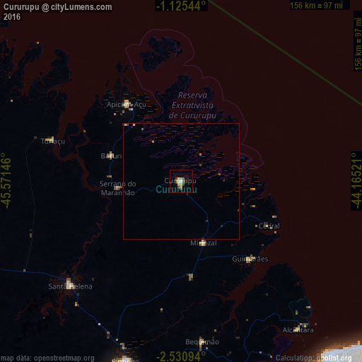
Analysis of Cururupu night lights 2016
Square area 10x10 km:
 0.65%
0.65%90-99
1.08%80-89
4.33%70-79
1.73%60-69
1.52%50-59
1.95%40-49
2.38%30-39
2.81%20-29
1.08%10-19
1.08%0-9
81.39%Square area 50x50 km:
0.03%90-99
0.04%80-89
0.23%70-79
0.08%60-69
0.1%50-59
0.15%40-49
0.16%30-39
0.16%20-29
0.19%10-19
0.07%0-9
98.79%Clear (daylight) street map image can be seen on geolist.org.
Map coordinates:
1° 7' 31.6" South, 45° 34' 17.3" West
1° 49' 42" South, 44° 52' 6" West
2° 31' 51.4" South, 44° 9' 54.8" West
Some cities around Cururupu sort by population:
• São Luís
100.2 km =62.3 mi,  141°
141°
• Pinheiro
80.7 km =50.1 mi,  197°
197°
• São Bento
96.6 km =60 mi,  176°
176°
• Santa Helena
65.6 km =40.8 mi,  226°
226°
• Turiaçu
58.9 km =36.6 mi,  288°
288°
• Cândido Mendes
103.4 km =64.2 mi, 294°
• Bequimão
69.7 km =43.3 mi,  172°
172°
• Alcântara
81.3 km =50.5 mi, 141°
3401148 (p: 22,007)
Sources (retrieved 2019-11-25):
» Earth at Night: Flat Maps 2012, 2016